
Hiking matters #497: Exploring Cagua volcano in the Northern Sierra Madre, Cagayan

 TUGUEGARAO CITY – It all began with a Google Earth search of the highest mountains in Sierra Madre. Mt. Bintuod in Nueva Vizcaya, Mts. Mingan and Anacuao in Aurora, Mt. Dos Cuernos in Cagayan, and several others emerged as candidates for the distinction of “highest” in each of their provinces and perhaps the entire range, but the real surprise to me was the presence of a caldera-looking topography in Gonzaga, Cagayan, which turned out to none other than Cagua Volcano. Largely unknown to mountaineers, this 1168-meter active volcano is part of the Babuyan island chain of volcanoes, and I lost no time in pursuing it as a possible exploration.
Last year, our trainee Julius de Vera and I went on an ocular to Cagayan to talk to the LGU and get contacts; last week we went back to do a two-day exploration of Cagua volcano, starting from Brgy. Magrafil. Getting to the trailhead is an achievement in itself: 10 hours by bus from Manila to Tuguegarao, 2 hours by van from Tuguegarao to Gonzaga, and 30 minutes by multicab from Gongaza to Magrafil.
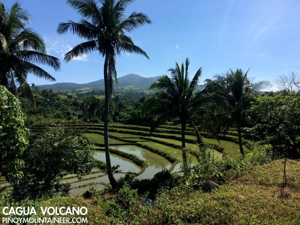
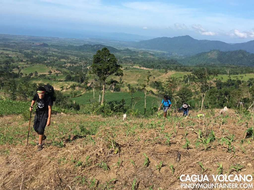
We started trekking at 1100H, immersing in the midday sun as we walked up a rough road surrounded by corn and rice fields up to 400 MASL. Even at this point, we could already see Palaui island (NE) and the faint outline of Camiguin island (yes, there is a northern version of the Camiguin in Northern Mindanao which is just as volcanic).
The rough road, evidently an old logging conduit transitions into tropical rainforest. The trail, similar to the trails of Cristobal and Isarog, is well-established, and as it ascends to 900 MASL the sufuric smell foreshadows the volcanic features we would later encounter.
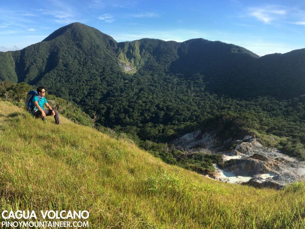
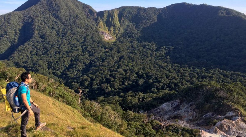
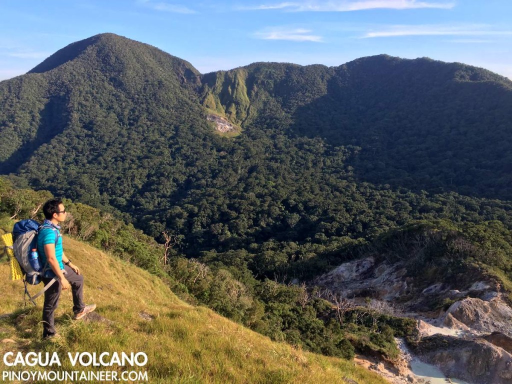
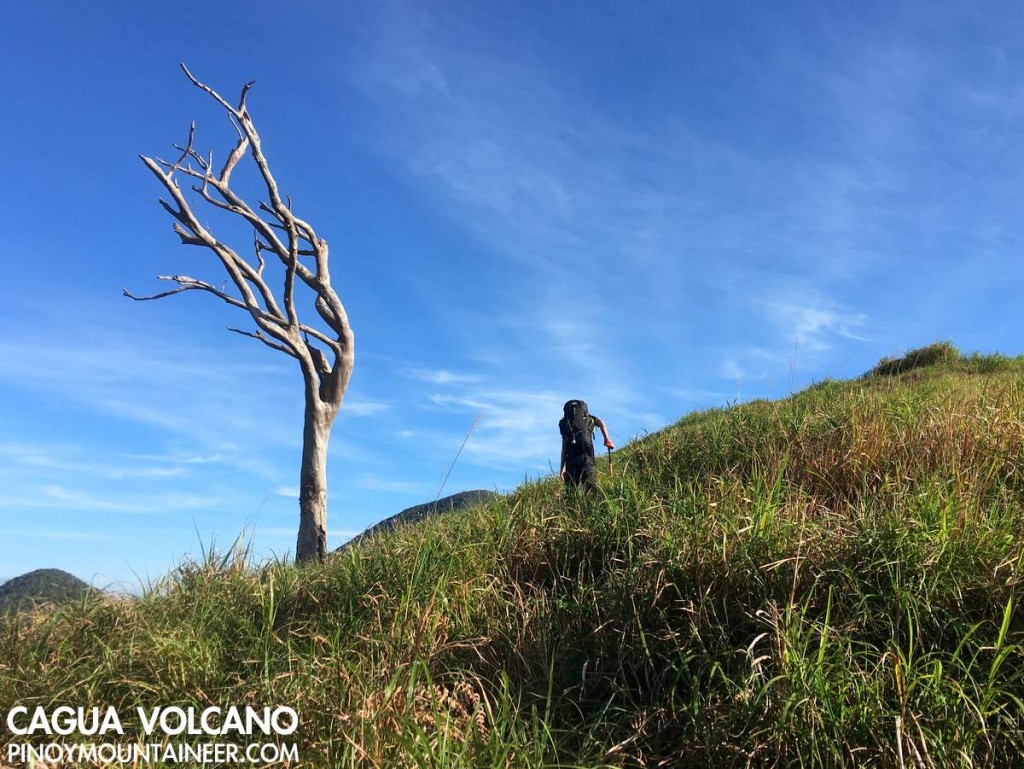
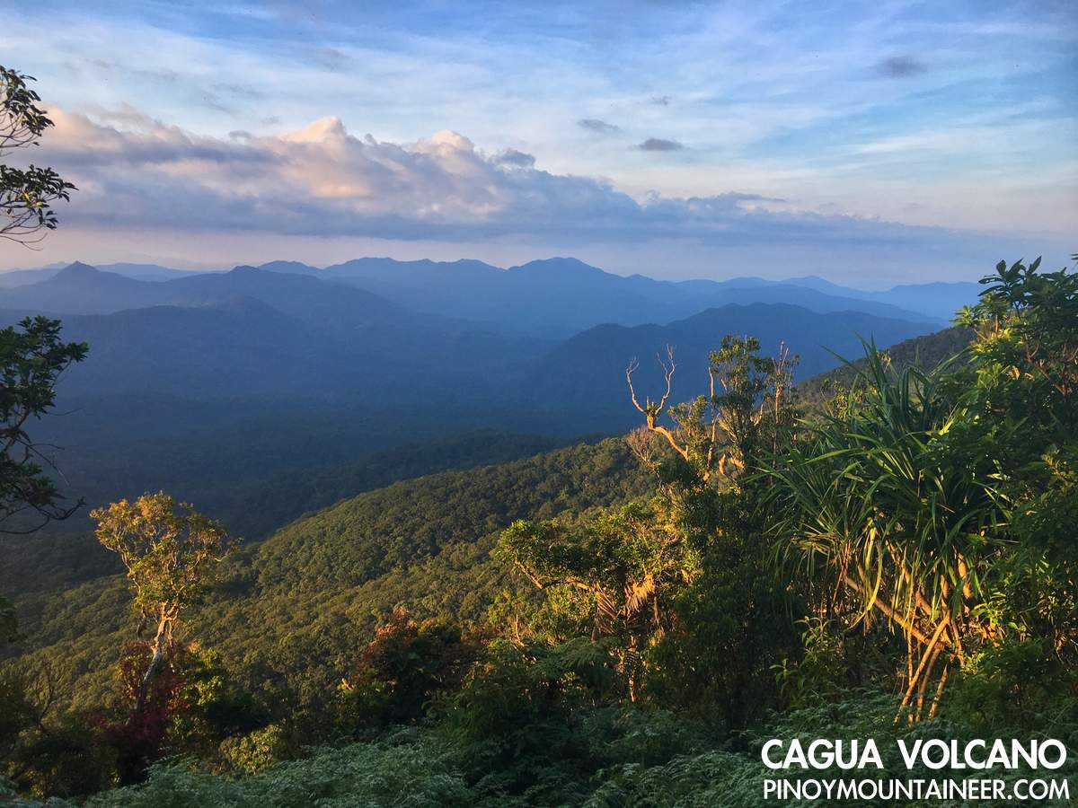
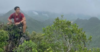
Finally, the forest gives way to grassy slopes that mark the North Rim of the caldera. Here – the highest point we reached at Day 1, the views are spectacular, with full view of the calera and its two fumaroles: one right beneath us, and the other on the opposite side of the rim, obliquely to the west of the summit. At the opposide side, on the other hand, one could see the coastal towns of Cagayan, from Aparri to Sta. Ana, with Palaui island at the northeastern tip.
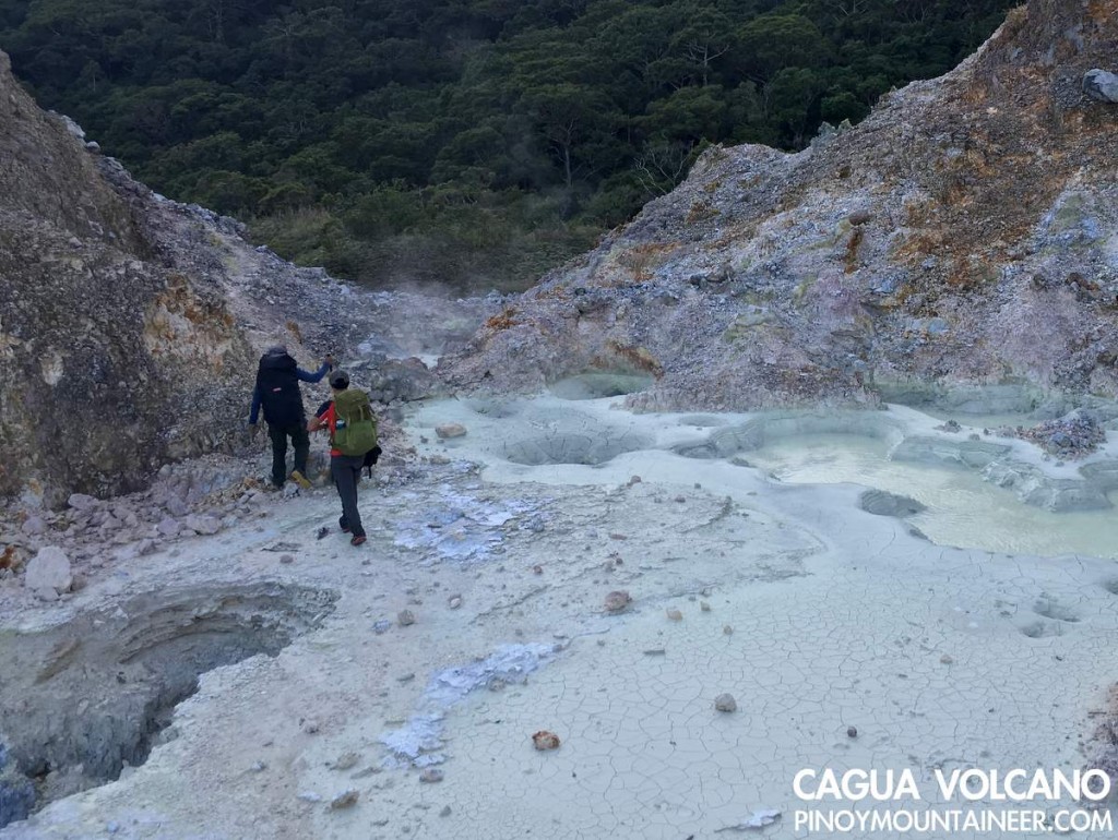
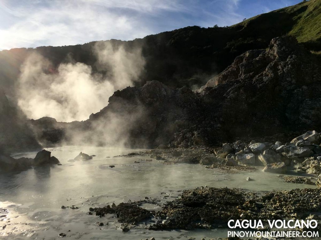
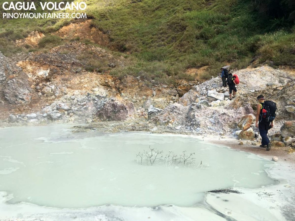
From the North Rim we descended to the campsite in the middle of the caldera, passing by the fumaroles. The trail edges perilously close to the boiling ponds of sulfuric water, and I nearly got into serious trouble by stepping onto the pond itself as some of the seemingly-solid rocks turned out to be but a layer of solid ground above the pond (This should serve as a warning to future hikers: Be careful when trekking in this area!).
From the northern fumarole, the forested campsite was just 20 minutes away, which was located near a water source. It was there, right in the middle of the caldera where we spent the night. Fortunately I found a nice spot to set-up my one-man tarp tent, and we were blessed with great weather.
***
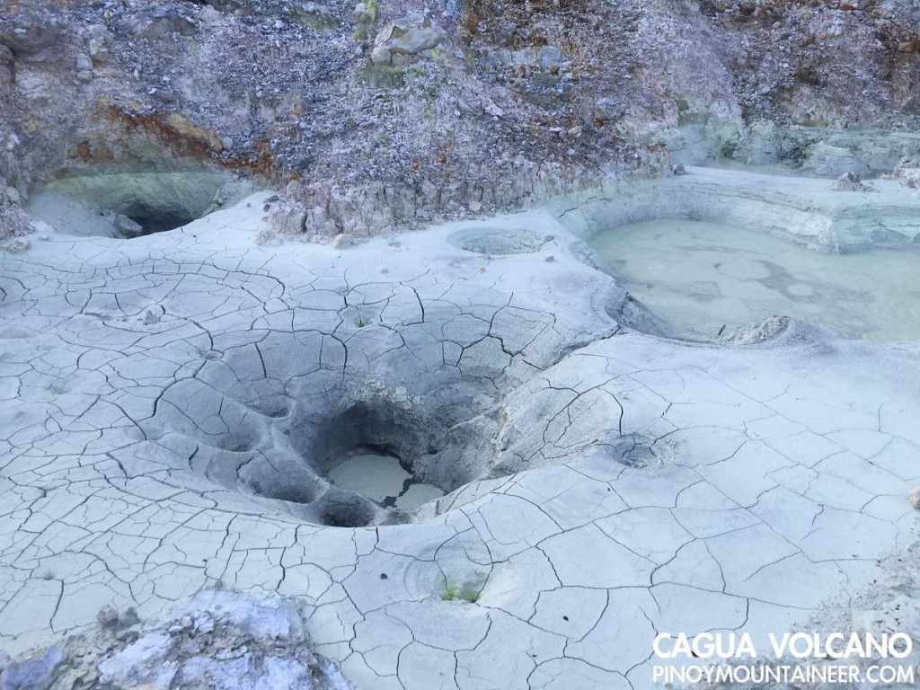
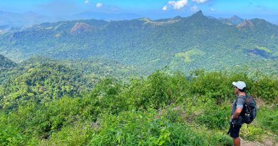
The next day, we woke up early to explore the other parts of the caldera, starting with the Southern Fumarole, which unlike the Northern one, is without ponds of boiling sulfuric water. Instead, it had lots of vents. We passed through these vents to reach the South Rim of the volcano, entering a nice forest to reach the summit of Cagua volcano, which registered an elevation of 1168m. As an additional highlight, from this forest one can have a glimpse of the countless peaks of the Northern Sierra Madre.
According to our guides, there are other trails in Cagua which are commonly used by the indigenous people who forage for rattan and other products: we did see some of the them during the previous day. Based on our guides’ accounts, then, there are traverse possibilities although for our purposes we were very satisfied with the extent of our exploration and we happily went back to the campsite. In all, the fumarole-and-summit excursion took less than 3 hours.
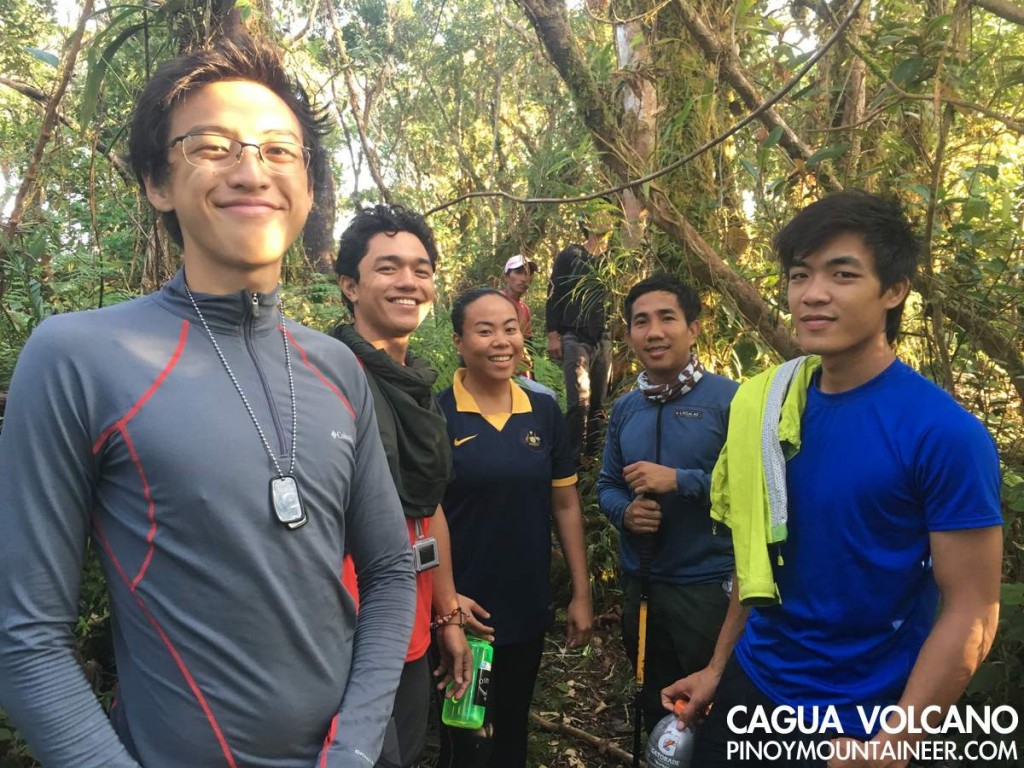
After breakfast at the campsite, we broke camp and headed back to the Northern Fumarole, then the rim, then marched back to Magrafil. As in Makiling and Tapulao, the rough road felt longer during the descent. Fortunately by 1300H we were back in the barangay and very soon we were making our way to Sta. Ana to reach the second leg of our adventure: Palaui island! Thank you Chuck ,Coby, Tin, Tony, Gab, Gonzalo, and Julius for joining!
Leave a Reply
Be the First to Comment!