Mt. Isarog/Panicuason Trail (1,966+)
MT. ISAROG (VIA PANICUASON TRAIL)Naga City, Camarines SurMajor jump-off: Brgy. Panicuason, Naga CityLLA: 13°40′ N, 123°21′ E, 1966 MASLDays requires
Read more

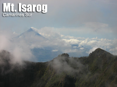
MT. ISAROG (VIA PANICUASON TRAIL)Naga City, Camarines SurMajor jump-off: Brgy. Panicuason, Naga CityLLA: 13°40′ N, 123°21′ E, 1966 MASLDays requires
Read more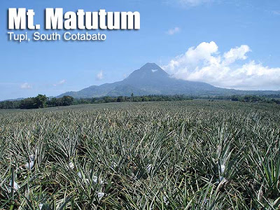
MT. MATUTUMTupi, South CotabatoMajor jump-off: Sito Glandang, Brgy. Kablon, TupiLLA: 6°22’N, 125°06.5’E, 2293 MASL Days required / hours to summit:
Read more
by Gideon Lasco This is an article belonging to the ‘climb health’ category in PinoyMountaineer. Information provided in this article
Read more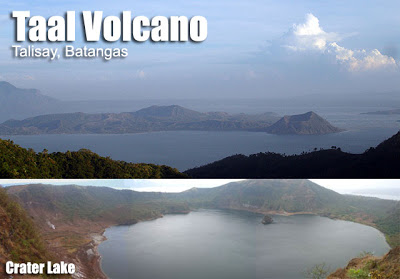
TAAL VOLCANOBatangas ProvinceJump-off point: Talisay, BatangasLLA: 14°00.1′ N, 120°59.1′ E, 311 MASLDays required / Time to summit: Half-day, 45 minutesSpecs:
Read more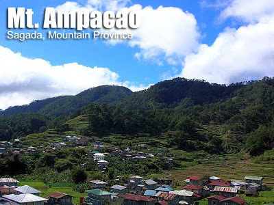
MT. AMPACAOSagada, Mt. ProvinceMajor jump-off: Ambasing Elementary School, Brgy. Ambasing, SagadaAltitude: 1889 MASL (386 meter gain)Days required / Hours to
Read more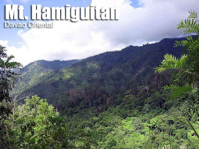
MT. HAMIGUITANDavao OrientalMajor jump-off: Brgy. La Union, San Isidro, Davao OrientalLLA: 6.745 N, 126.174 E, 1620 MASLDays required / Hours
Read morePinoyMountaineer.com classification system, version 1by Gideon Lasco To address the need for a more precise classification, PinoyMountaineer is adopting a
Read more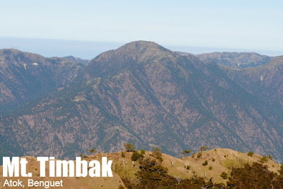
MT. TIMBAK/ MT. SINGAKALSA (2,717+) Atok, Benguet Major jumpoff: KM. 55, Atok, Benguet Elevation: 2717 MASL (#9) Days required /
Read more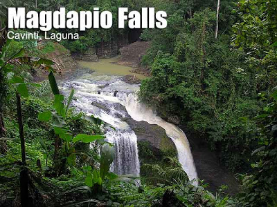
MAGDAPIO (PAGSANJAN) FALLS VIA CAVINTI LAND ROUTECavinti, LagunaMajor jump-off: Brgy. Tibatib, CavintiHeight of waterfalls: 90 metersTime to waterfalls / Days
Read more
TATLONG KRUS AND MATABUNGKA FALLSPaete, LagunaMajor jump-off: Brgy. Ilaya Norte, PaeteHeight of waterfalls: 20-25 metersHours to summit / days required:
Read more