
Hiking matters #49: A dayhike traverse of Mt. Arayat


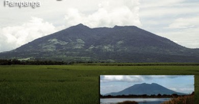
Today, I did the traverse of Mt. Arayat, from Magalang to Arayat, passing by the North and South Peaks of the mountain, and between them, the famed and precarious rock called Haring Bato in the traverse trail, the hardest part of the climb. My friend Julian joined me, and guiding us was Kevin, 17, mountaineer from Cavite, together with his girlfriend Chen.
Since we had a vehicle with us, the first question was which trail to take first. Since we were parking at the DENR outpost in Brgy. San Juan Bano, past the Arayat resort (notorious for hecklers), it was very tempting to just start trekking. But Kevin recommended the Magalang trail. For one, it is more covered than the initial grass/woodland of Arayat. Secondly, the northwestern location of Magalang would buy us time before the sun hits us. And that would work for our benefit too on the way back.
So after parking our car at DENR, we commuted to Magalang. A tricycle ride, then a jeepney ride taking the Arayat-Magalang-Angeles route, and finally another trike that took us to the trailhead, past the military camp. We started trekking by 0900H.
We soon entered a forest, highlighted with large rocks; it was continuously forested – thankfully – and steep, reminiscent of Tarak Ridge. It would have made a very nice trail if not for the almost continuous trail of trash. Indeed, the garbage scattered all around the place totally ruined the scene! Anyhow, after 2hrs 45 mins, we reached the North Peak. By our GPS readings this is actually the higher of the two peaks, and thereby the actual summit of Arayat at 1010 MASL.
The noontime views were unremarkable. The soldiers were friendly. Very soon we pushed onwards to do the traverse. As Kevin promised, it’s not at all like the open ridges of other mountains, open to the scorching sun. It was breezy and forested – sometimes, too forested, with some of the bad elements like rattan and lipa.
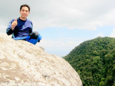
As I said, I think the highlight of the traverse is a quick scramble up Haring Bato – the gigantic rock perched in between the two peaks. It requires some techinical skills to manuever yourself up the crest of the rock, which is very thin. Up there, when you look down your vision plummets down easily 400-600 meters! So hold on for dear life – this is even more precarious than Pico de Loro’s spire and calls to mind G2.
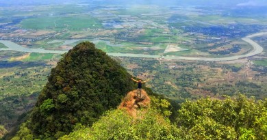
The trail moves on, bypassing the landslide with a parallel, steep trail — but there is no need to worry at all with the landslide being prohibitive for mountain climbing activity. By 1400H, we had arrived at the South Peak (SP) – in all it took around 100 minutes to negotiate the traverse trail, including the stop at Haring Bato.
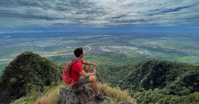
Having already visited the viewdeck near SP, we didn’t bother to revisit it. Instead, we trudged steadly downward, and by 1630H we were driving past the Arayat Resort – finally a overcharge-free, totally enjoyable Arayat climb!
PinoyMountaineer thanks Kevin Arenas of AUP – Silang, Cavite for being the guide for the blogger’s trip on March 30, 2009. Photos courtesy of Julian Canero of the UP Med Outdoor Society.
Leave a Reply
5 Comments on "Hiking matters #49: A dayhike traverse of Mt. Arayat"
Ako rin, planning to climb Arayat this Black Saturday. Sana may makasabay ako.
My friends and I are planning to go to Mt. Arayat during the holy week. Where can we find local tour guides?
sir Gid, are you sure its Indang, Cavite? The only AUP (Adventist University of the Philipppines) is in Silang, Cavite.
…dayhike traverse of arayat, cool!
…an aeta guide told us before that there is also a small falls inside arayat, sana ma feature mo rin sir in the future…
…cheers, peace & bleesings…
nice trek, nice pictures! pde plng idayhike ang arayat trav…