
Hiking matters #450: Mt. Arayat Traverse from Magalang to Arayat, revisited

Six years after I first did the Mt. Arayat Traverse, I returned, following the same trail that I took in preparation for our unforgettable Visayan Voyage in April 2009 (see Hiking matters #49). This hike is a perfect complement to the Makiling Traverse I did the other week, the two mountains being the two ‘Marias’ of the North (Mariang Sinukuan) and the South (Mariang Makiling) respectively – important geographic and cultural landmarks.
Magalang to Arayat, or vice versa? Geography took part in our decision-making. I mentioned the benefits of going from Magalang to Arayat, that is, North to South, in my previous entry:
For one, it is more covered than the initial grass/woodland of Arayat. Secondly, the northwestern location of Magalang would buy us time before the sun hits us. And that would work for our benefit too on the way back.
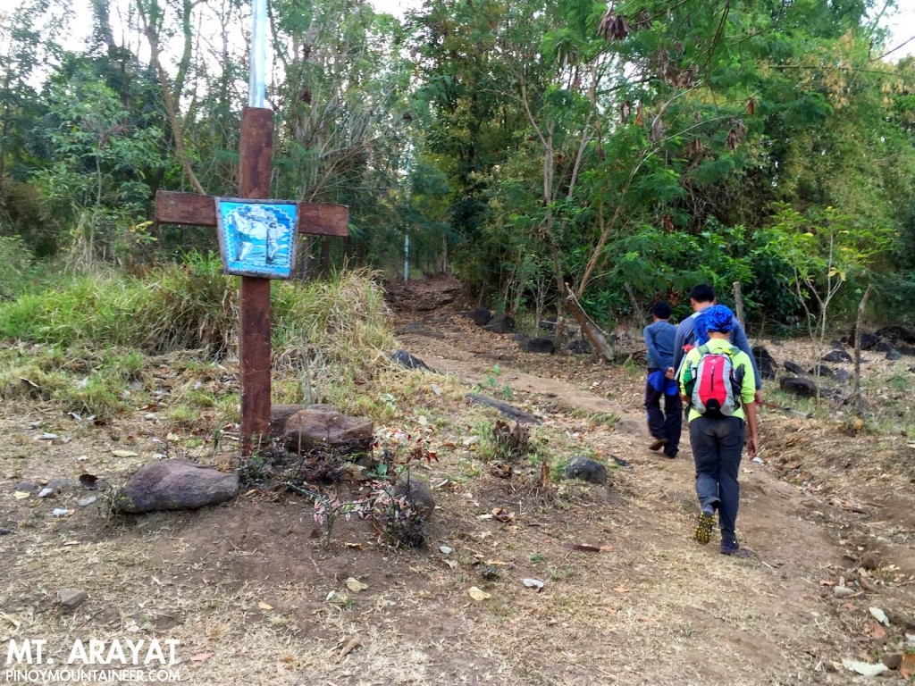
We arrived at the trailhead at Brgy. Ayala, Magalang at around 0630H, and started trekking shortly after. Generally shaded, the trail was dry and dusty (maalikabok) but pleasantly well-established. Many locals pass through the trail to reach the Puting Bato – a shorter hike that leads to a scenic rock formation within the mountain.
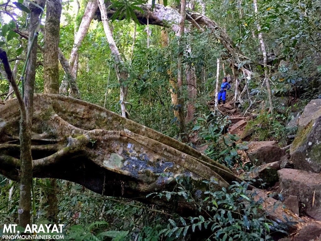
There were two choices of trail to take – one steep but short, the other longer but scenic. We favoured the latter, and was rewarded with the sight of beautiful balete trees that reminded me of the overgrown temple ruins in Cambodia. Just as surely as there are limitik in Makiling, there were mosquitoes in the trail. And, as with Makiling’s little menaces, I just took them in stride.
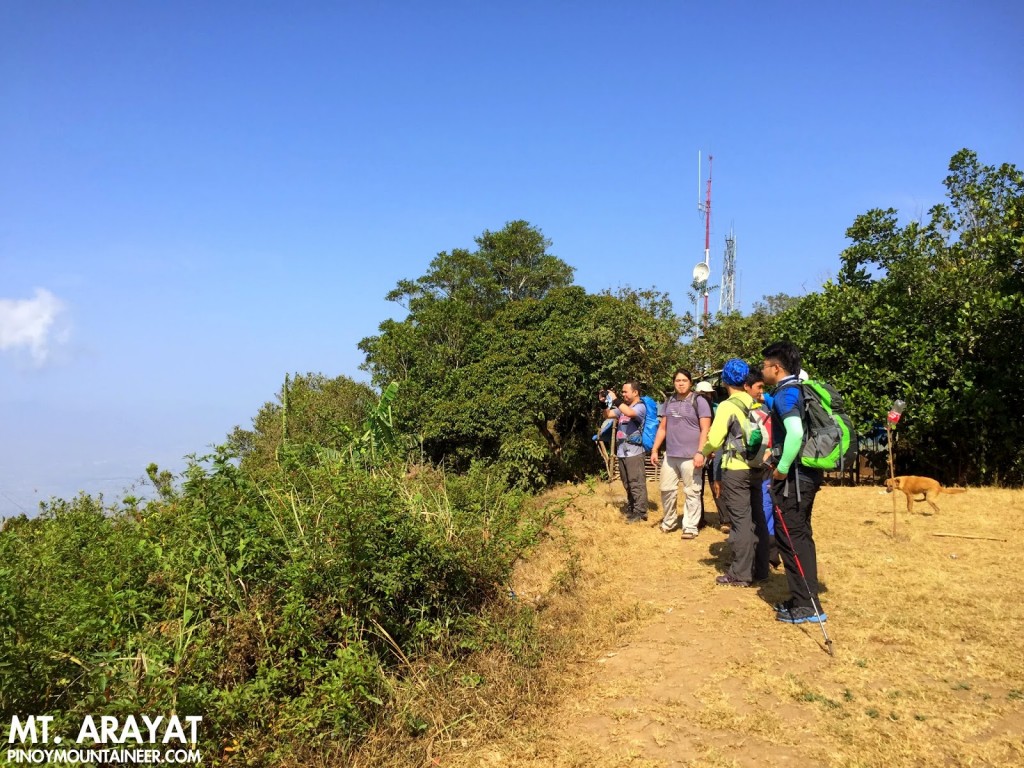
By 1000H we were in the North Peak, which has a small military outpost. In the past, rumours and reports of insurgency have created the impression that Arayat is a dangerous mountain and this view still lingers, but for several years Arayat has been very safe and we have not heard of any untoward incidents.
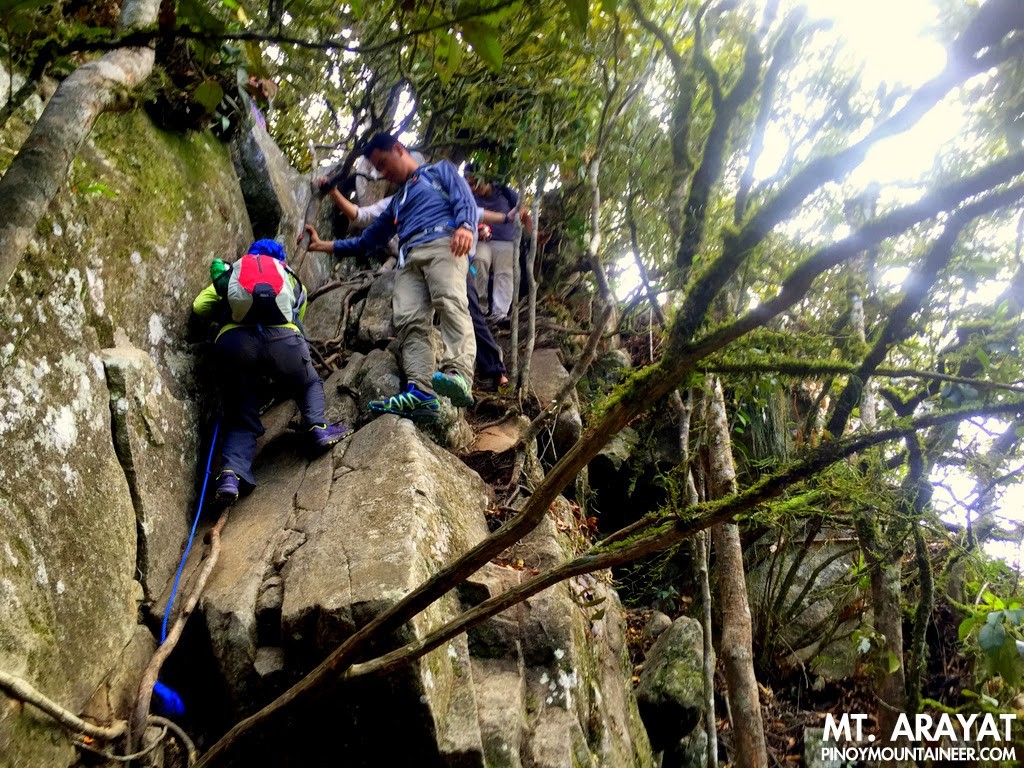
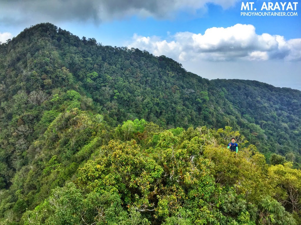
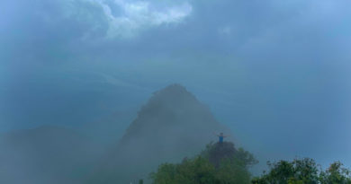
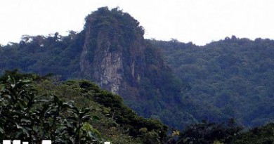
The most exciting part of the Arayat Traverse is trekking the ridge between the North and the South Peaks. Taking about an hour, it features forested ridges reminiscent of the Pantingan-Tarak Traverse, as well as scenic rock formations that go up the crest of the forest. There used to be a giant rock here called ‘Haring Bato’ – we still saw it in 2009 – but a landslide caused this rock to cleave into pieces, altering the landscape, but with the beauty of the scenery intact.
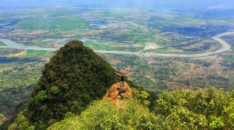
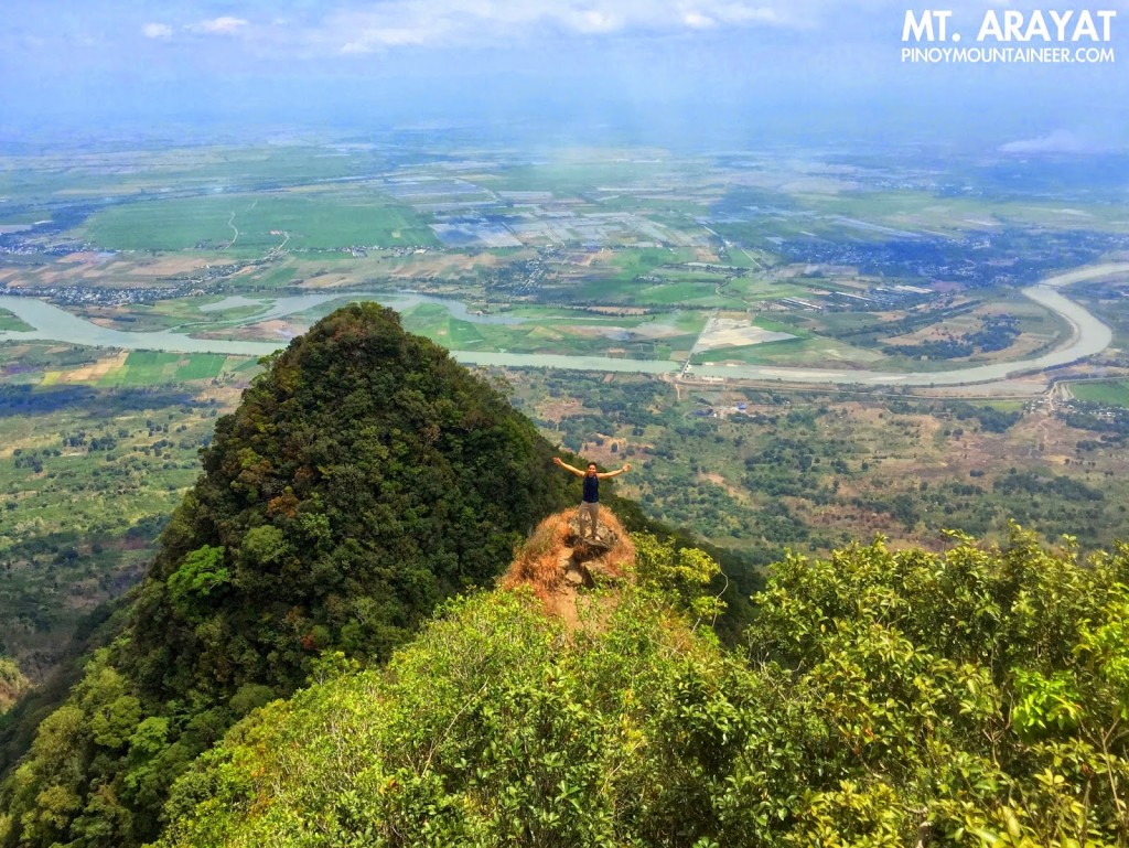
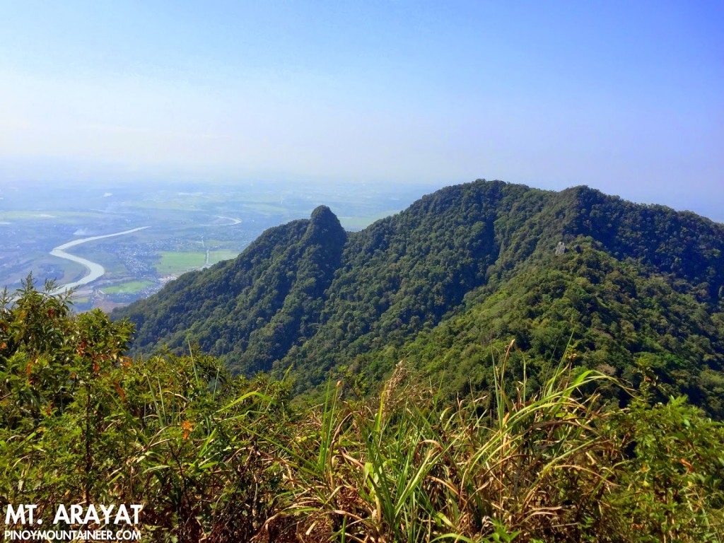
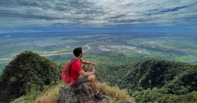
Compared to the Makiling Traverse from Peak 3 to 2, Arayat’s traverse section isn’t overgrown, and the ups-and-downs not that pronounced – though there . Thus it is really a pleasant walk. South Peak itself is an unremarkable grassy protrusion; the main attraction of the area is a small peak past the campsite which offers a view of Arayat’s horn as well as the vast plains of Central Luzon, with Pampanga River meandering through it.
We had lunch at the South Peak campsite, then proceeded to do the descent. The first part has lots of rocks, which gradually recede as you lose elevation. Then it’s just forest, until it gives way to open, grassy slopes, some parts were charred because of a recent brush fire. This part of the hottest in the trail, but at least we were already descending. Actually from that part, the end of the trail isn’t too far. In all, the descent took us just two hours or so. There is now a cement road all the way to the monitoring station, whereas six years ago it was still rough road. (In my first hike up Arayat, way back 2007, we even had to walk all the way from the resort.)
What can I say about the hike? It has way more trash than Pico de Loro, and a lot of mosquitoes, but in the end, Mt. Arayat turned out to be a more pleasant and cooler hike than I remember from my two previous hkes. The two viewpoints – at Haring Bato midway through the traverse and near the South Peak – are great attractions, and so are the ridges and the majestic trees in the Magalang side. Indeed you can never judge a mountain on a basis of one or two climbs, just as you cannot judge a person with just one or two encounters. Keep visiting; keep climbing! Treat the mountain as a friend, and you will be rewarded.
PINOYMOUNTAINEER IN MT. ARAYAT
1 Mar 2007 (before PinoyMountaineer)
Leave a Reply
3 Comments on "Hiking matters #450: Mt. Arayat Traverse from Magalang to Arayat, revisited"
Hi Sir!
We did the Magalang- Arayat Traverse last saturday. that was my first major climb thanks for your recent blog malaking tulong sir.We survived kahit walang guide. Super the best 🙂
Good Day!
Hi Sir, fixed na po ba yung rope doon sa ridge?thanks. 🙂
hi sir!dun sa ridge fixed na po ba ung rope doon?
thank you!