
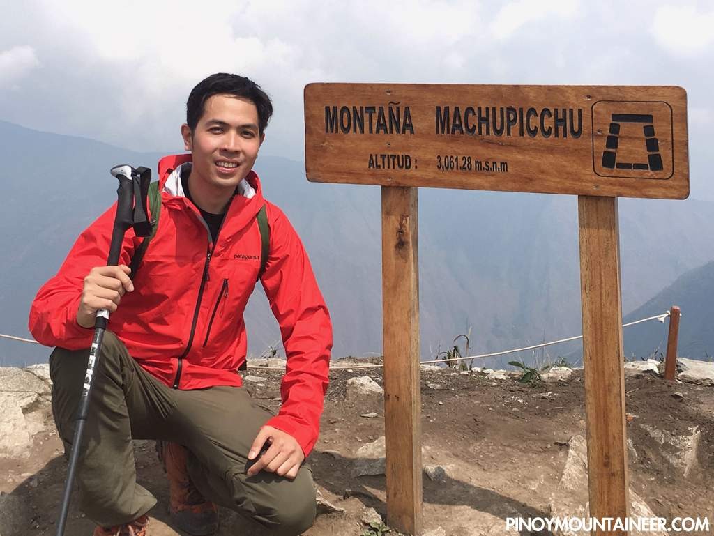
Hiking matters #510: Hiking up Machu Picchu Mountain (3061m) in the Peruvian Andes

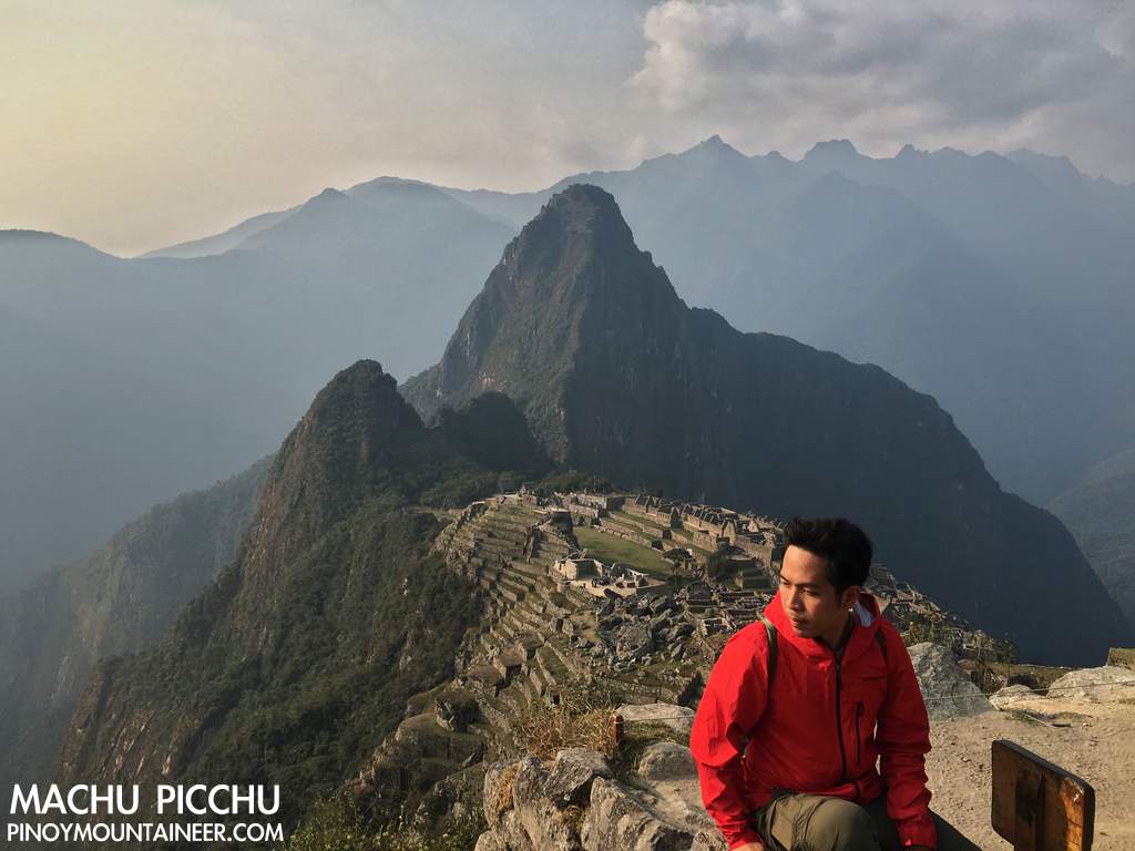
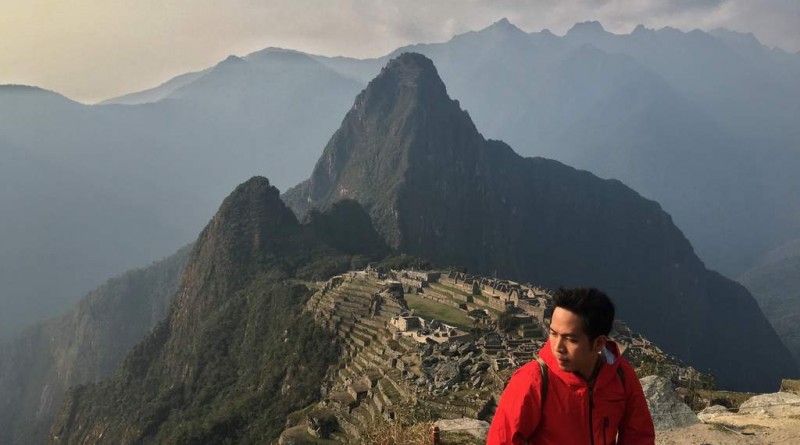
CUSCO, PERU – Yesterday I went up Machu Picchu, one of the most famous archeological sites in the world, and hiked up Machu Picchu Mountain (3061m), the mountain after which the site is named – and on whose slopes it sits.
The Inca Trail, of course, is the most famous way to get to Machu Picchu, but it’s also the most expensive – and requires reservations way in advance. Since I just decided to go to Machu Picchu the week before, I had to look for alternatives. Fortunately, I discovered that there’s actually various hikes that one can do – going to, going around, and going beyond the mountain. Most of them are actually also Inca trails, characterized by stone steps.
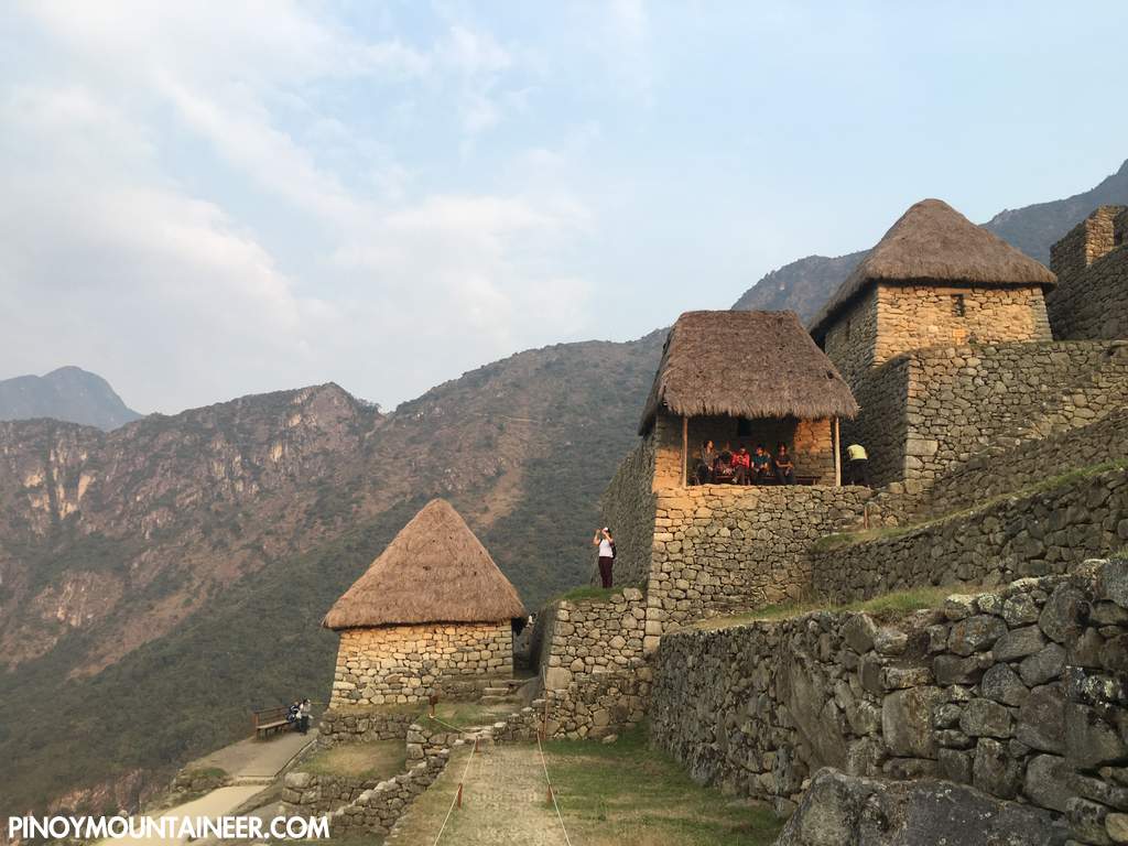
The day before the hike up Machu Picchu Mountain, I already did an afternoon hike around Machu Picchu, trekking to the Inca Bridge with a plank of wood that they can easily remove to prevent enemies from approaching, and to the famed Temple of the Condor near the trailhead to Huayna Picchu. Because the late afternoons are the only times when there won’t be any crowd. I wanted to bask in the beauty of the site and take pictures without the crowd – so that when I actually do the hike, I can go straight to the Montaña without bothering with the famous attractions within the site.
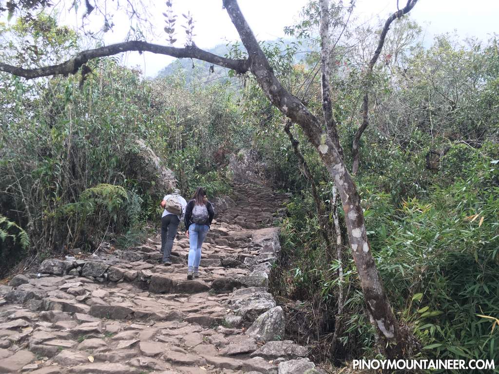
The following day, I started my hike from the town of Aguas Calientes, also known as Machu Picchu Pueblo, after taking a colectivo from Cusco to Ollantaytambo, then a train (Inca Rail) from Ollantaytambo to Aguas Calientes. From Aguas Calientes (2030m), I took the hiking trail (“Camino Peatonal”) up Machu Picchu, which initially involved walking on the bus road – before entering a stone path.
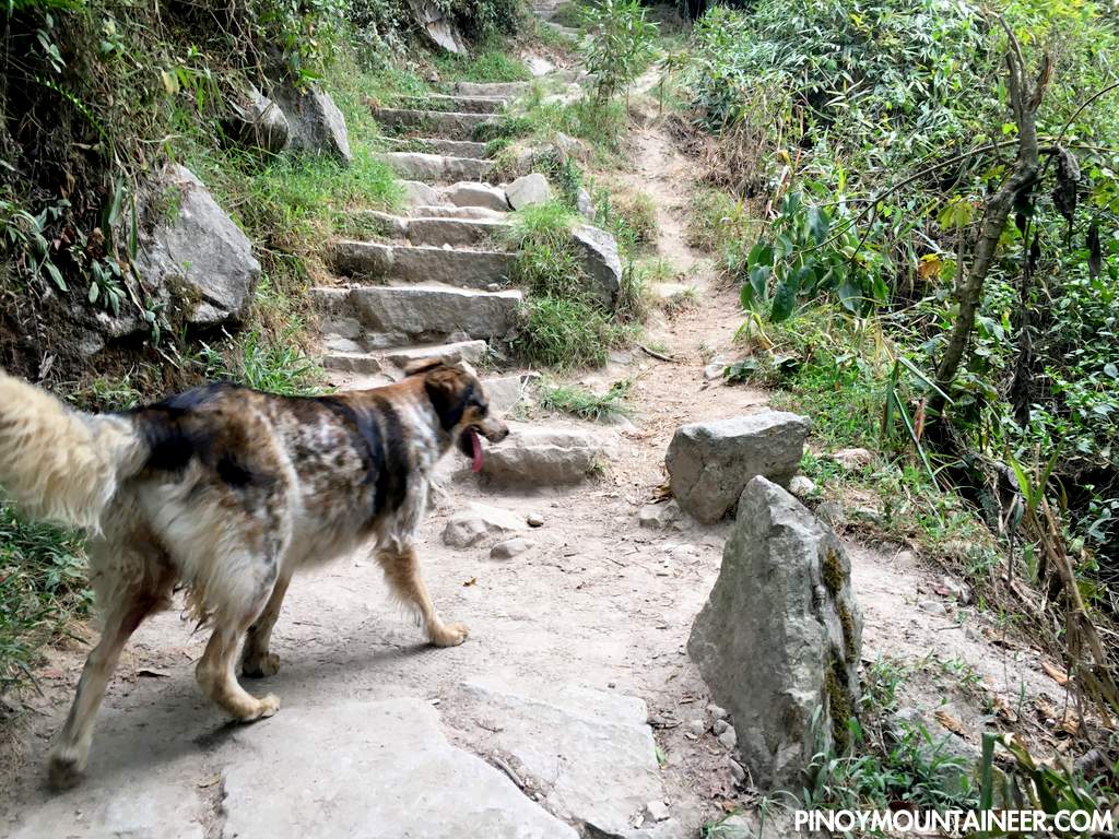
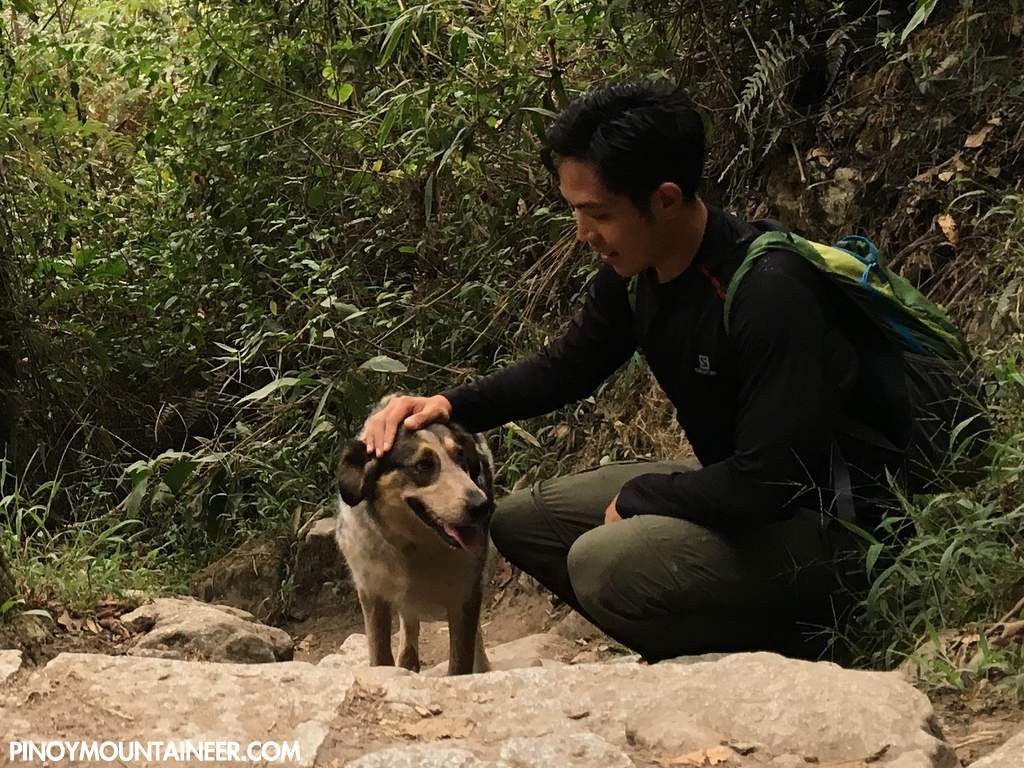
As I was about to go up this trail, a dog appeared in front of me and began following / guiding me up! I called him Allqu, the Quechua term for dog. Allqu accompanied me all the way through the well-established stone trail (with several road crossings) to the park entrance of Machu Picchu. It took me less than an hour to do the Camino Peatonal.
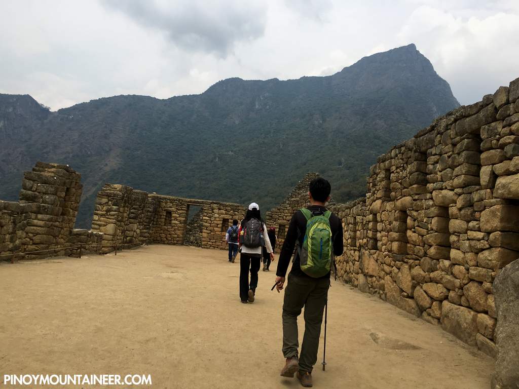
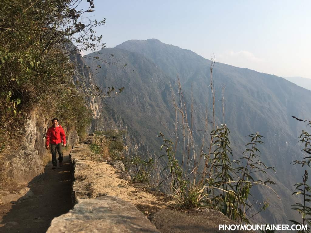
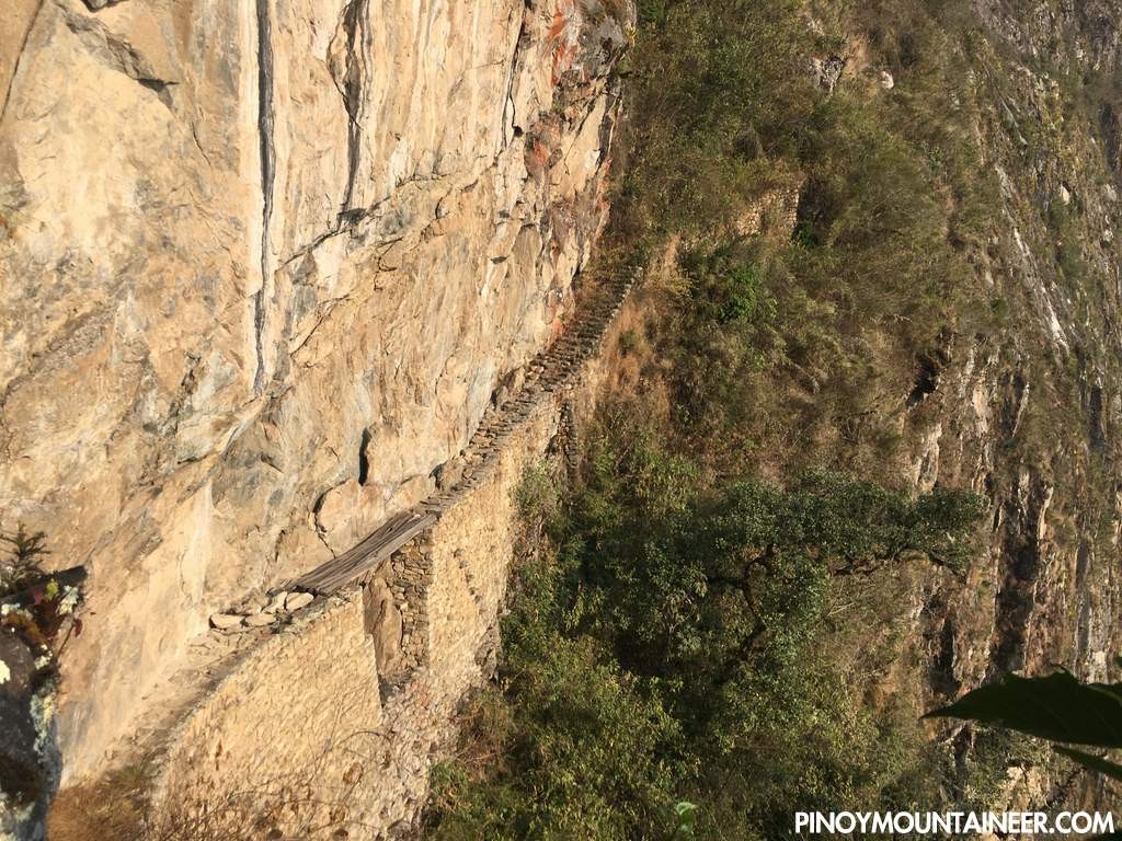
Once inside Machu Picchu I immediately headed up to the trailhead of Machu Picchu Montaña. The trail was again composed of a stone footpath that gradually narrowed and got steeper as we went higher. Only 400 hikers are allowed per day up the mountain, and many of them are tourists, so it took me just half the estimated time of 2-2.5 hours to reach the summit.
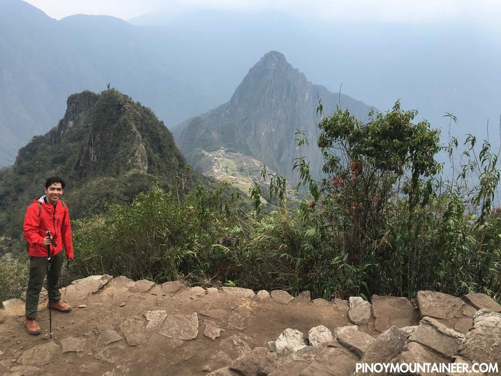
The fact that the highest point was just over 3000 meters meant that my lungs had a much easier time compared to the 5035-meter Rainbow Mountain the other day!
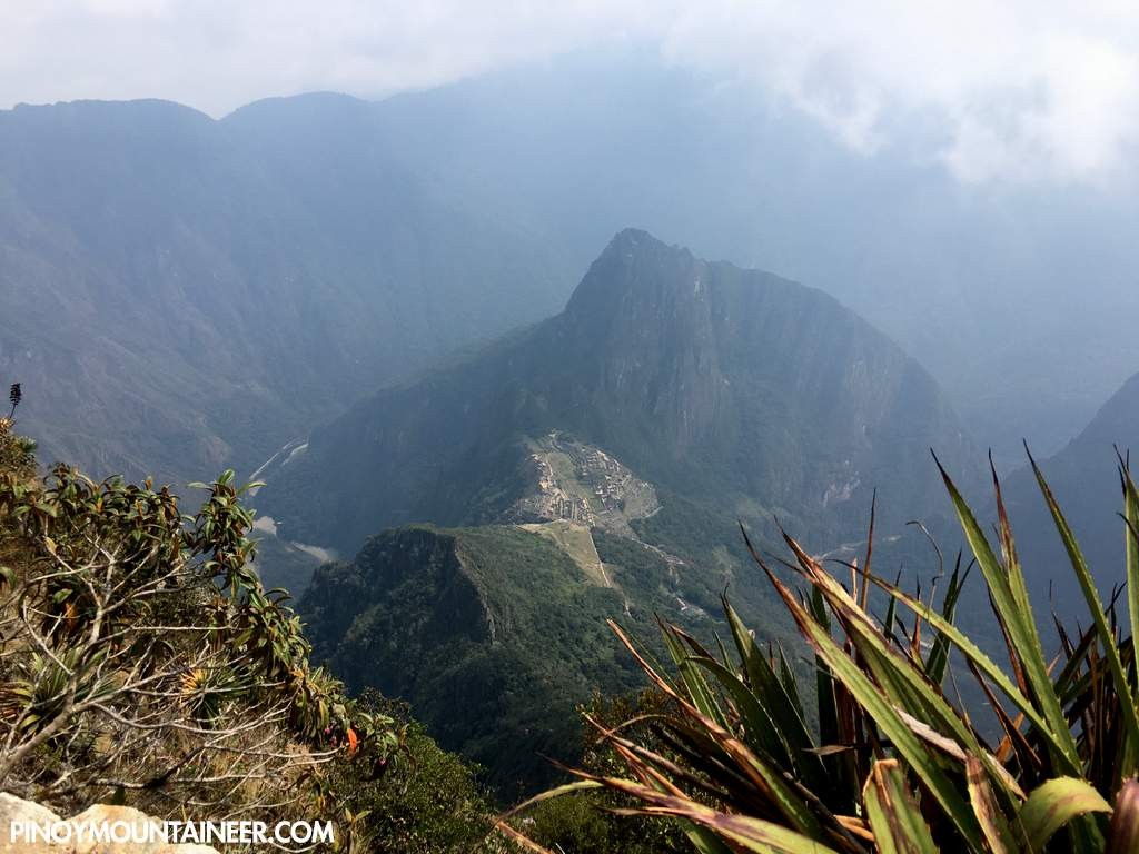
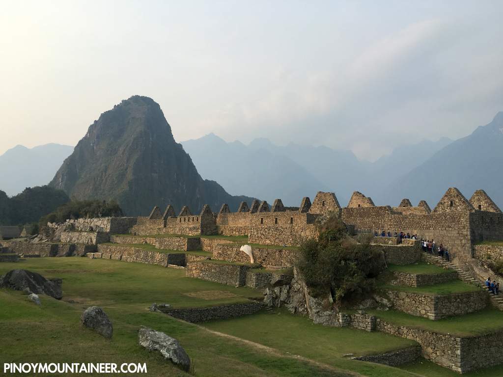
At the summit the views of Machu Picchu were stunning, and you could seen Urubamba River meandering its way around the beautiful peaks. Huayna Potosi, of course, towers above the ruins.
From the summit the descent was straightforward – though care must still be applied as the trails are narrow and one wrong step can kill you especially if you are careless (a German tourist died in Machu Picchu Mountain last July while posing for a photo). Back the main ruins, I did some further exploring but there were too many people compared to my relatively-solitary walk the other day. So after a while I returned to Aguas Calientes and took the train back to Cusco.

Leave a Reply
Be the First to Comment!