
Hiking matters #547: Smith Volcano (Mt. Pokis) in Babuyan Island

Continued from Hiking matters #546: From Calayan Island we proceeded to Babuyan Island to formally commence our series of volcano hikes. Babuyan Island – one of the most fascinating in the country – is home to the Ibatan tribe (not to be confused with the Ivatans of Batanes with a v, although they are culturally and linguistically related), who hold title to the entire island as their ancestral domain.
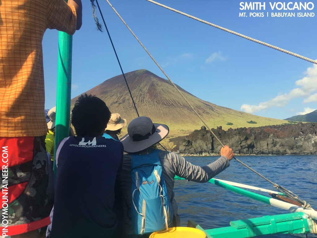
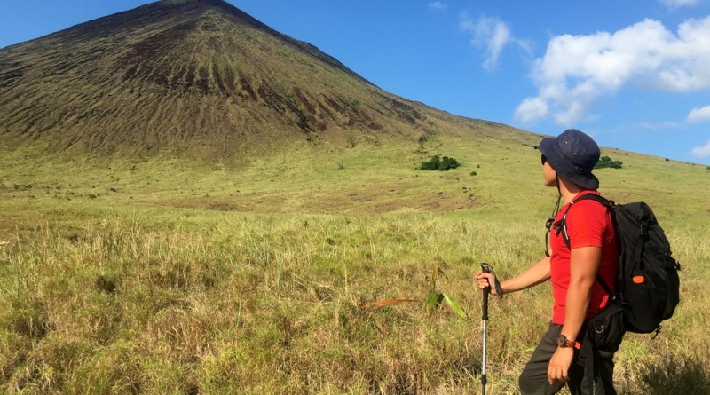
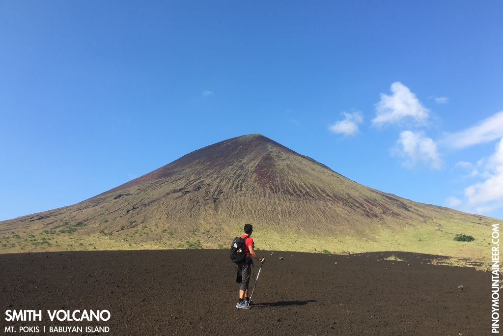
In our approach to the island we were welcomed by the green-brown conical Smith Volcano (Mt. Pokis) – in my opinion second only to Mayon in beauty among the country’s volcanoes. Behind it stood the more forested, cloud-capped Mt. Babuyan Claro (Chinteb na Wasay). Pokis in Ibatan means ‘bald’ and is used to describe the volcano’s barren slopes.
As we followed the southern coast of the island we passed through Asked village, home to a black sand beach that doubles as a hot spring thanks to the island’s unique geology. It is marked by a lighthouse similar to the one in Sibang Cove in Calayan. Then, at the end of the coast we reached the main docking area, under the shadow of a hill on the southeastern tip of the island.
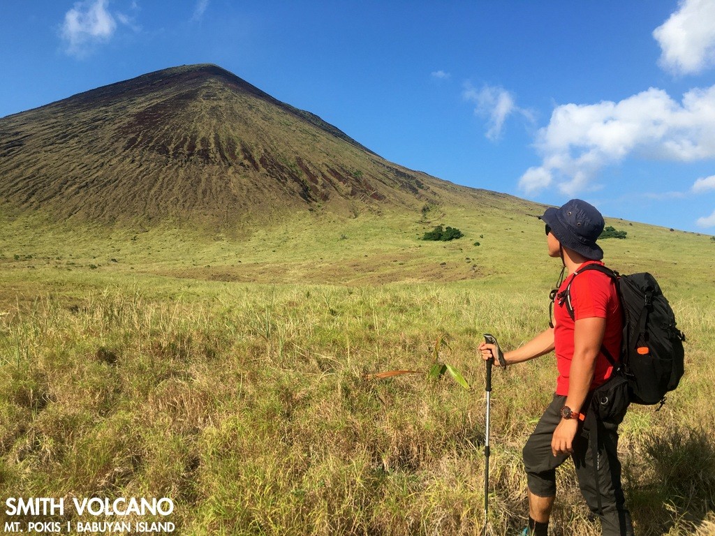
After doing the formalities – a process that requires a P500 entrance fee to the island and some patience as the islanders are not used to receiving visitors – we returned by boat to Asked village, and went a bit beyond to commence a hike of Mt. Pokis accompanied by two guides, Danilo and Narciso. There is no trail whatsoever; one just has to follow the contour of the volcano and choose how gradual or steep you want your hike to be. We ended up following the contour of the volcano.
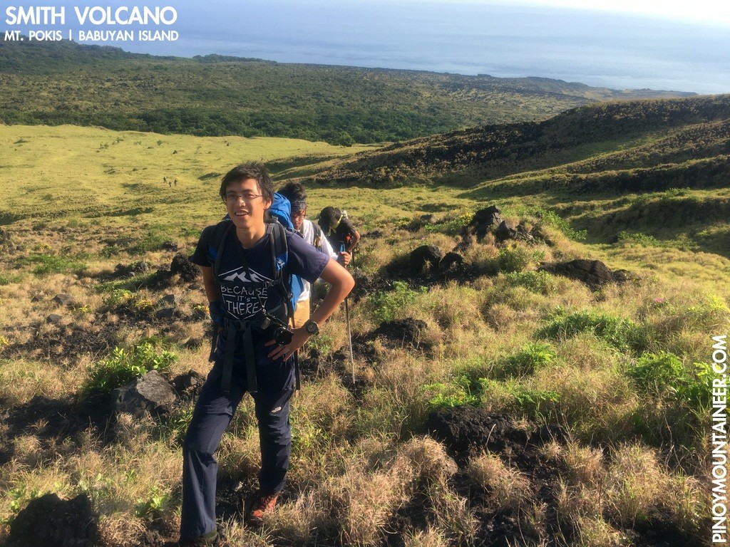
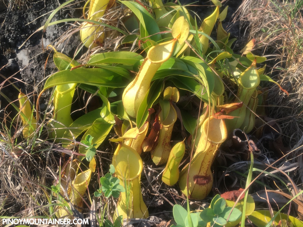
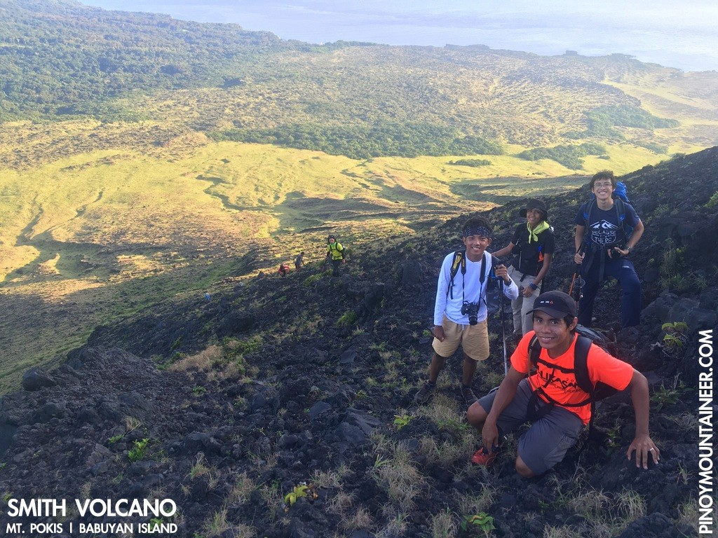
The first part is made up of volcanic sand. Very much reminiscent of Mayon, much of the trail is made up of black rocks, gravel, and sand with some unique vegetation – including a superabundance of pitcher plants. At the higher reaches of the slope, it becomes precarious, akin to a scree slope – caution is advised for possible falling rocks.
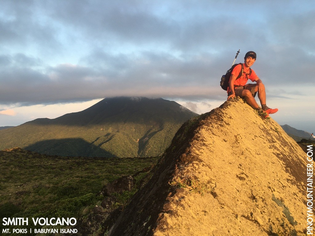
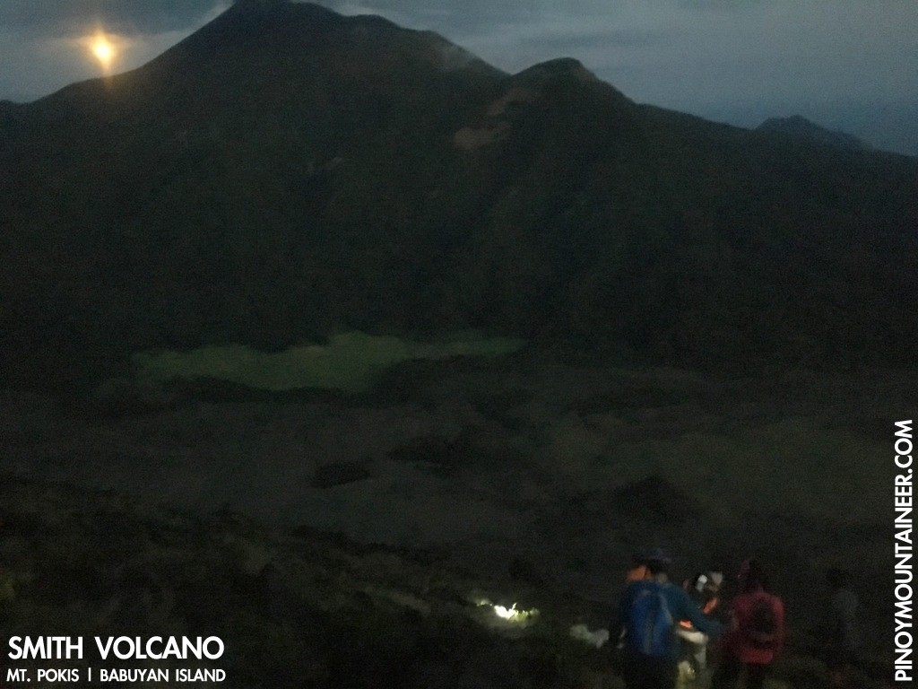
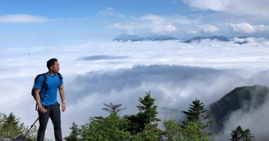
The summit is marked by a number of large rocks, the highest of which is pyramidal in shape and can count as the marker (see photo above). There, one can see both Camiguin and Calayan islands, and behold the majesty of Babuyan Claro as well as the forests and the fields under its shadow. We awaited the sunset, then testily descended the volcano this time heading towards an eastern direction to hit the forest which then led us to Asked village.
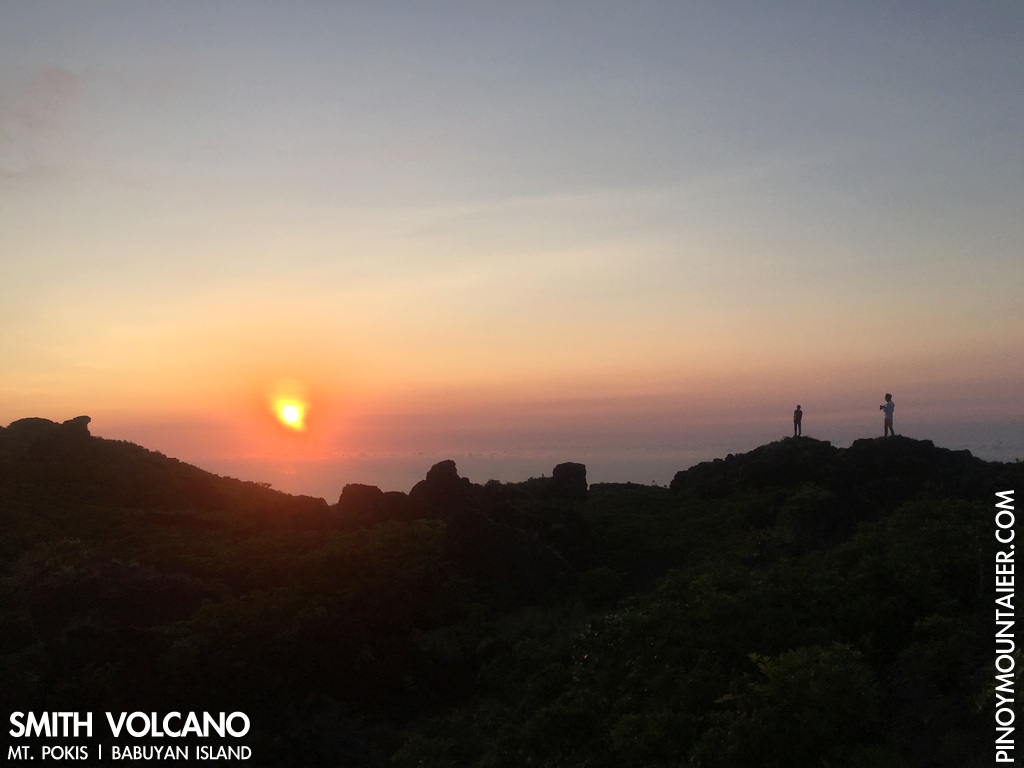
As we were hiking during the Holy Week our evening trek was graced by a full moon, and so was the boat ride back to the ‘Centro’. Upon reaching our homestay we were treated to a feast of seaweed salad, lobsters and various fish – capping off a most amazing day of adventure.
Note: Babuyan Island is a pristine area and the entire island must be respected as a nature sanctuary and a cultural community. Because there is no waste disposal facility in the island, Pinoy Mountaineer strongly recommends taking your trash with you back to Luzon mainland.
VOYAGE TO THE VOLCANIC ISLANDS OF BABUYAN
Hiking matters #546: Trekking in Calayan Island, Babuyan
Hiking matters #547: Smith Volcano (Mt. Pokis) in Babuyan Island
Hiking matters #548: Mt. Babuyan Claro (Chinteb a Wasay) in Babuyan Island
Hiking matters #549: A visit to Didicas Volcano, Philippines’ youngest island
Hiking matters #550: Hiking up Mt. Camiguin de Babuyanes
Leave a Reply
Be the First to Comment!