
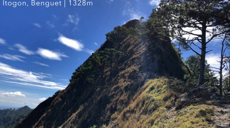
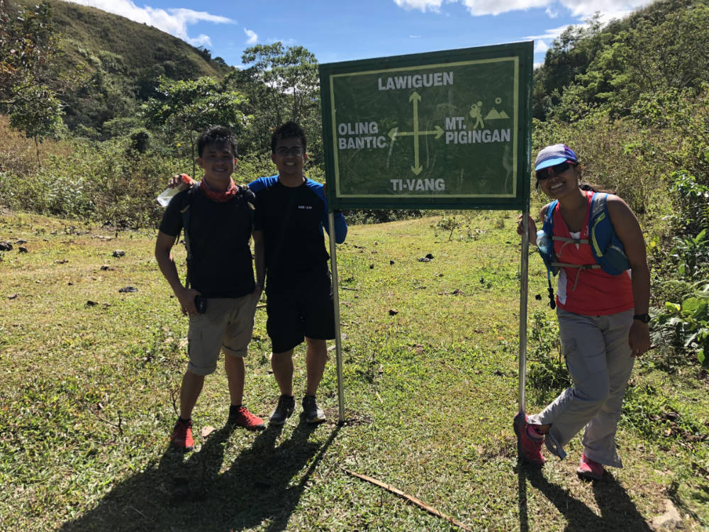
Mt. Pigingan (1328m) in Itogon, Benguet


MT. PIGINGAN
Itogon, Benguet
Major jumpoff: Sitio Balocloc, Brgy. Dalupirip, Itogon
LLA: 1328 MASL (to be verified)
Days required / Hours to summit: 1-2 days / 5-7 hours
Specs: Borderline major, Difficulty 4/9, Trail class 1-4
Features: Pine forests, scenic views of the Cordilleras
Article history: Created 6-Jan-2018 by Gideon Lasco
BACKGROUND
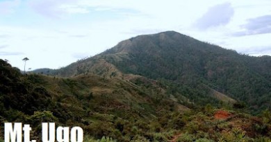
The hiking landscape in the Cordilleras has greatly expanded in the past few years, and among them are a growing number of dayhike possibilities from Baguio City. Among these, by far the most popular has been Mt. Ulap. For those wishing for a more serious dayhike, however – or even a new, relatively-relaxing overnight hike – there’s Mt. Pigingan in Itogon, Benguet, just under the shadow of Mt. Ugo. Though a low-altitude mountain – 1328m – by Cordillera standards, this mountain, which means “slanted” in the local language, nonetheless possesses the elements of a classic hike in the region.
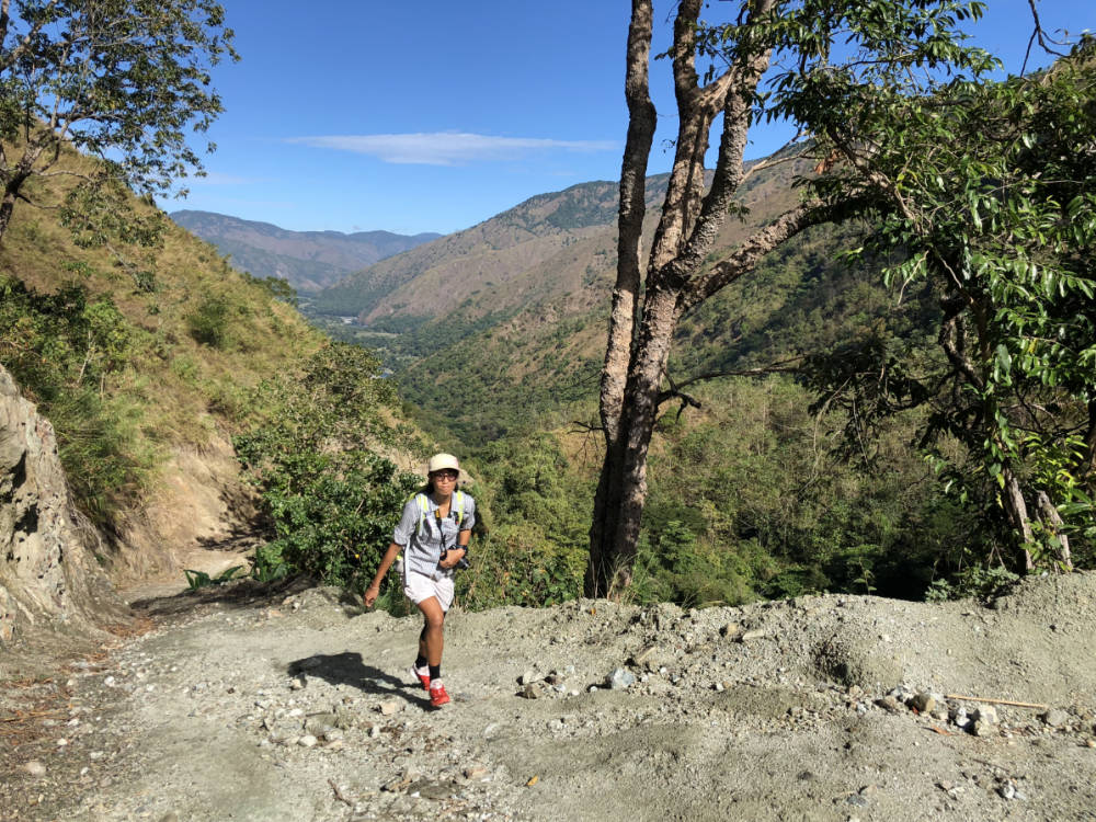
The trip to Pigingan takes the hiker the same way to Brgy. Tinongdan, one of the major trailheads of Ugo, but the trip continues for 8 more kilometres to Sitiop Balocloc in Brgy. Dalupirip, making for a total of a 1.5-2-hour jeep or van ride from Baguio City. The hike, which initially courses along the banks of Agno River, heads to a couple other hamlets before proceeding with the hike proper. Because the location of Mt. Pigingan places it close to Pangasinan and the lowlands, expect a warmer-than-usual Cordillera hike especially at the initial sections. There have also been reports of niknik (i.e. gnat or sandfly) bites especially along the riverbanks (although this could be truer during the wet season as the author didn’t encounter any during his hike in January 2018).
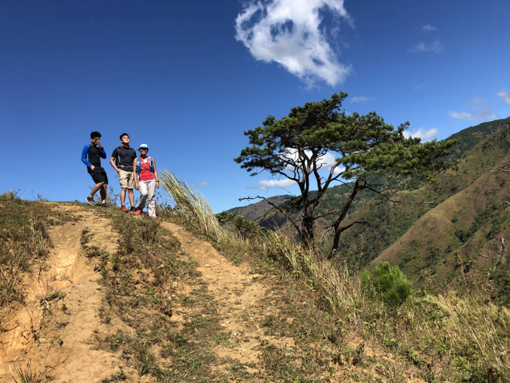
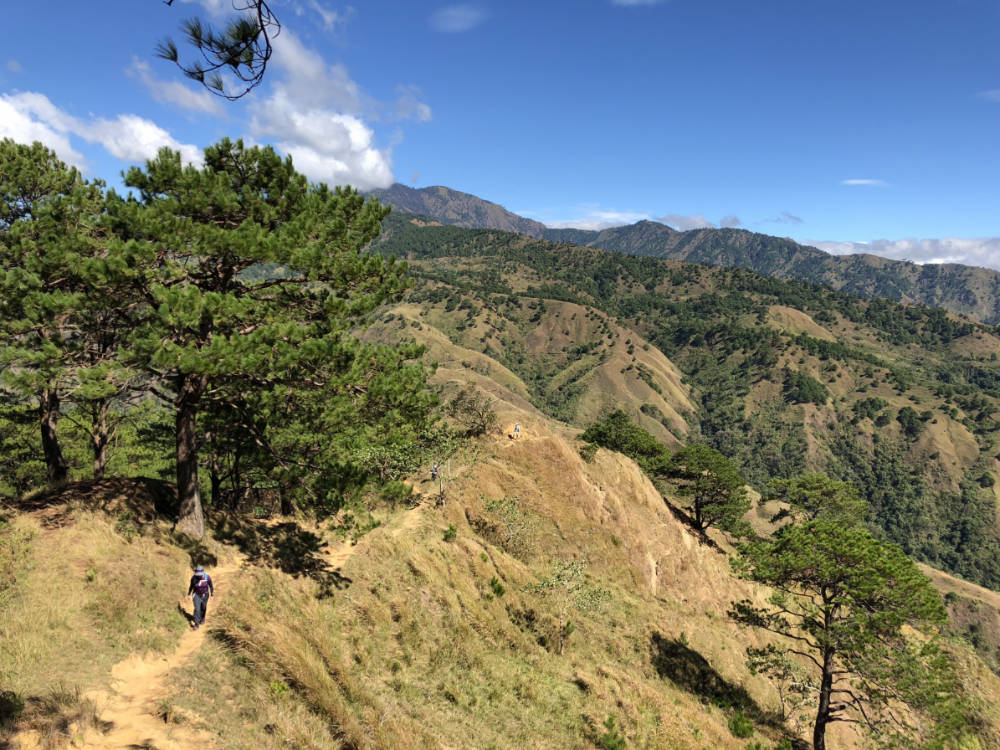
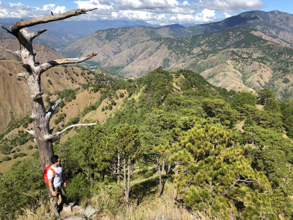
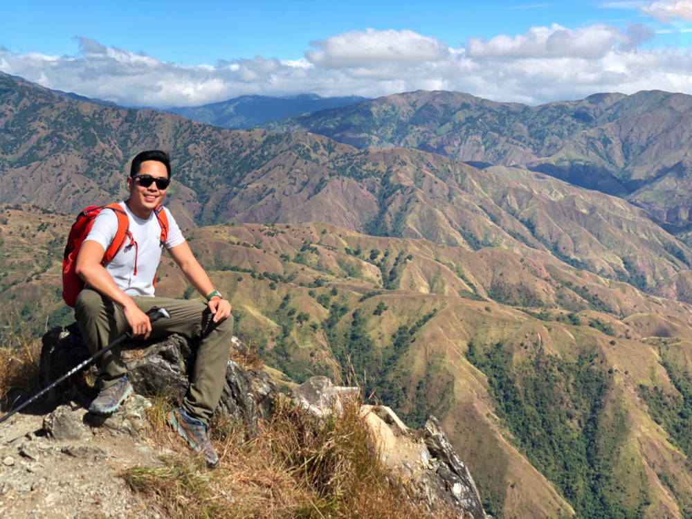
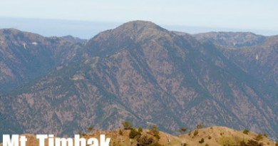
A junction which doubles as a rest area marks the halfway point; the real ascent to Pigingan proper begins at this stage; there is also the possibility to traverse to Mt. Ugo. If proceeding to Pigingan, the hike is typical Cordillera: village paths – i.e. future roads – that lead to pine forests, refreshing winds, scenic views of the mountains, and occasional cattle encounters. The summit (1328 MASL) is a prominent rocky peak, from which one can view the surrounding semi-barren, semi-pine hills dominated by Ugo, Binga Dam, and, to the south, the lowlands of Pangasinan.
Mt. Pigingan does not reach the grandeur of Pulag or Napulauan nor their lofty elevation, but given its proximity to Baguio City and the fact that it is a more serious hike than Ulap, it is nonetheless a very welcome addition to the Cordillera hiking scene. At the same time, possibilities for a traverse to Mt. Ugo makes it a possible gateway to longer adventures.
ITINERARY
DAYHIKE
Day 1
(2300 Leave Pasay or Cubao for Baguio)
0400 ETA Baguio City. Take chartered jeep to Brgy. Balocloc*
0600 Arrival at Sitio Balocloc. Register and secure guides.
0630 Start trek
0900 Arrival at junction
1200 ETA summit
1300 Start descent
1630 Back at trailhead; tidy up
1700 Take jeep back to Baguio City
1830 Back in Baguio City. Dinner
(2100 Take bus back to Manila)
OVERNIGHT
Day 1
(0100 Leave Pasay or Cubao for Baguio)
0600 ETA Baguio City. Take chartered jeep to Brgy. Balocloc*
0800 Arrival at Sitio Balocloc. Register and secure guides.
0830 Start trek
1200 Arrival at junction. Lunch
1300 Resume trek
1600 Arrival at Camp 2. Set up camp.
1700 Optional ascent to the summit for sunset
1800 Dinner / socials
Day 2
0530 Optional ascent to the summit for sunset
0700 Back at campsite. Breakfast / Break camp
0900 Start descent
1200 Lunch
1400 Back at trailhead; tidy up
1500 Take jeep back to Baguio City
1700 Back in Baguio City. Dinner
(2100 Take bus back to Manila)
Notes in the itinerary:
1. See other transport options below
2. An even-earlier start is recommended for those who wish to avoid sun overexposure
PRACTICALITIES: MT. PIGINGAN
| Transportation | Public (1) Jeep, Baguio Center Mall to Itogon [75 mins; first trip 6am] then (2) Jeep, Itogon to trailhead [40-60 mins, approximately 4 trips a day; last trip 5:30 pm] OR (1) Take direct jeepney rom Baguio Center Mall – only 1-2 trips a day that leave around lunchtime.Approximately 3 hours travel time from Baguio Chartered. Jeepney (or even taxi) from Baguio City to trailhead, 1.5-2 hours. Rates are usually negotiable depending on number of people, whether the vehicle will wait, overnight vs. dayhike, etc. |
|
| Registration | (1) Logbook at trailhead; P100 registration fee; Walk ins possible | |
| Guides | Available P500/day (for up to 7 persons) | |
| Contact numbers ✆ | Guides – Jeep Rental – 09198169234 Note: Please provide more contact numbers – they are more than welcome. |
|
| Campsites and waypoints ⛺ | (1) Camp 1 – Junction 🚰 (2) Camp 2 – Ambel 🚰 (~5 min) |
|
| Water sources 🚰 | Multiple water sources from Agno River to 1000m. Last reliable water source 5 minutes away from Camp 2. | |
| Cellphone signal 📶 | Highly limited in lower reaches; present in upper reaches. | |
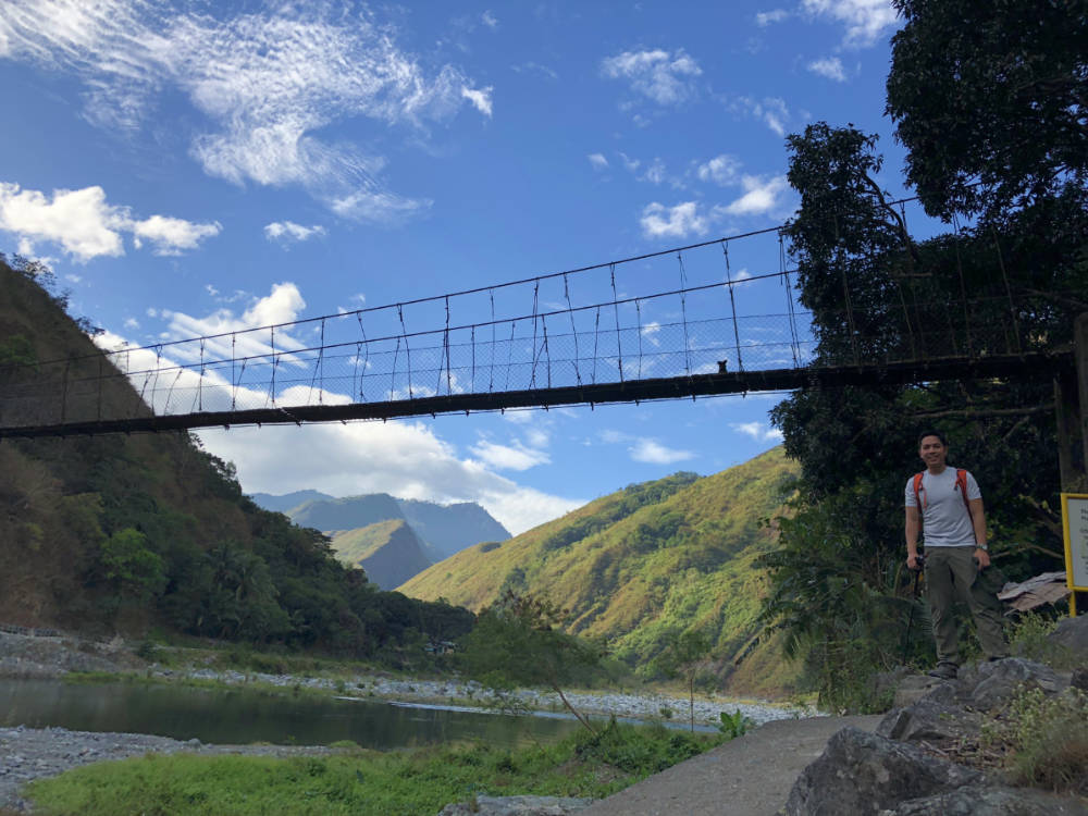
| River crossings | There is a hanging bridge Agno River (+30 min from start). No unsupported river crossings. | |
| Roped segments | None | |
| Limatik | None | |
| Lipa | None | |
| Rattan |
|
|
| Hiking notes | Niknik (gnats or sandflies) reported during the rainy season. | |
| Sidetrips | Baguio City itself; Mt. Ulap | |
| Alternate trails | There is a traverse to Mt. Ugo (+1-2 days) | |
| Dayhikable | Yes, but not recommended for beginners. Consider an early start especially if not confident about pace and endurance | |
| Facilities at jumpoff | (+) Sari-sari stores (+) Parking |
|
| Estimated budget | P800-1000 from Baguio City for a group of 7-10 if renting a jeepney; P2000 from Metro Manila. |
MT. PIGINGAN PICTURES
TRIVIA
Mt. Pigingan is very near the “tri-border” of Ilocos Region (Pangasinan), CAR (Benguet), and Cagayan Valley (Nueva Vizcaya).
Agno River, which is a prominent part of the Pigingan landscape, is over 200 kms long, originating at the Mount Data area in Benguet and empties into the West Philippine Sea through the Lingayen Gulf in Pangasinan. There are three dams in Agno: Binga Dam – visible from Pigingan – the very-familiar Ambuklao Dam, and San Roque Dam.

Leave a Reply
Be the First to Comment!