
Mt. Ulap (1846m) in Itogon, Benguet

MT. ULAP ECO-TRAIL
Itogon, Benguet
Entry point: Brgy. Ampucao, Itogon
Exit point: Brgy. Sta. Fe, Itogon
LLA: 16.2904 N, 120.6312 E, 1846 MASL (Mt. Ulap)
Days required / Hours to summit: 1 day / 2-3 hours
Specs: Difficulty 3/9, Trail class 1-3,
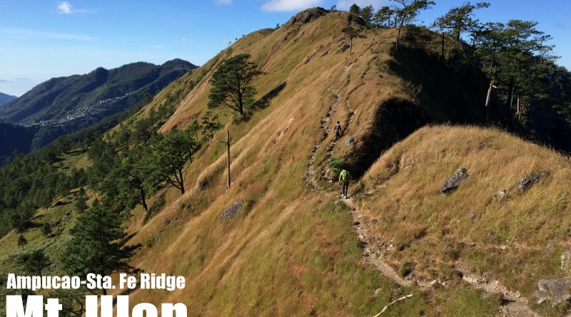
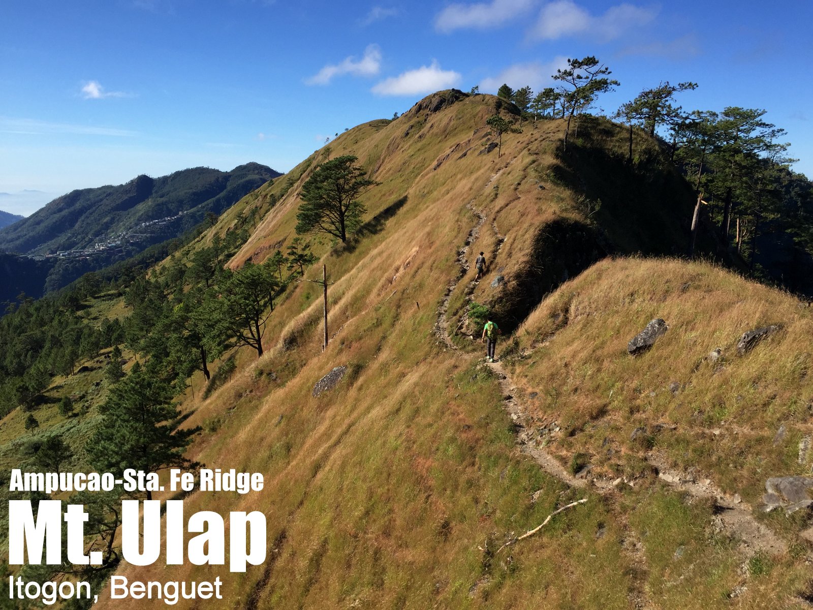
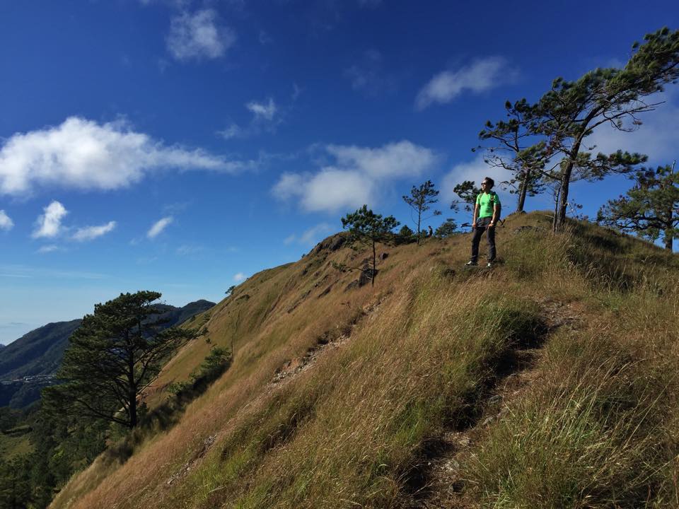
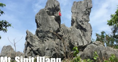
Features: Grassland and pine ridges, scenic views of the Cordilleras, burial caves
Article history: Created 30-Nov-2015 by Gideon Lasco
BACKGROUND
A “mini-Mt. Ugo” which showcases the best of what the Cordilleras has to offer: Pine and grassland ridges with stunning views of the mountains, and even a glimpse of culture with villages, burial caves, and hanging bridges, the Mt. Ulap Eco-Trail in Itogon, Benguet is the perfect dayhike from Baguio City, only 40 minutes away from Burnham Park by public jeepney. Spanning around 8 kilometres through several peaks along the Ampucao-Sta. Fe Ridge (not to be confused with the Philex Ridge), it is easy enough to be completed from 4-6 hours, making it feasible as a dayhike or even a half-dayhike for hikers of all levels.
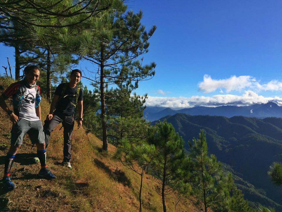
The trailhead starts along from the road to Philex in Brgy. Ampucao, but as of December 2015, hikers have to make a 10-minute detour to the barangay hall to register and secure guides (required). The trail goes up a ridgeline that is immediately surrounded by pines, and soon becomes scenic with views of Mt. Sto. Tomas and Baguio City; the perennially mist-covered Central Cordilleras from Ugo to Pulag; and to the south, even Mt. Arayat.
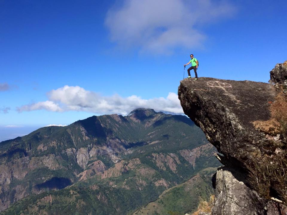
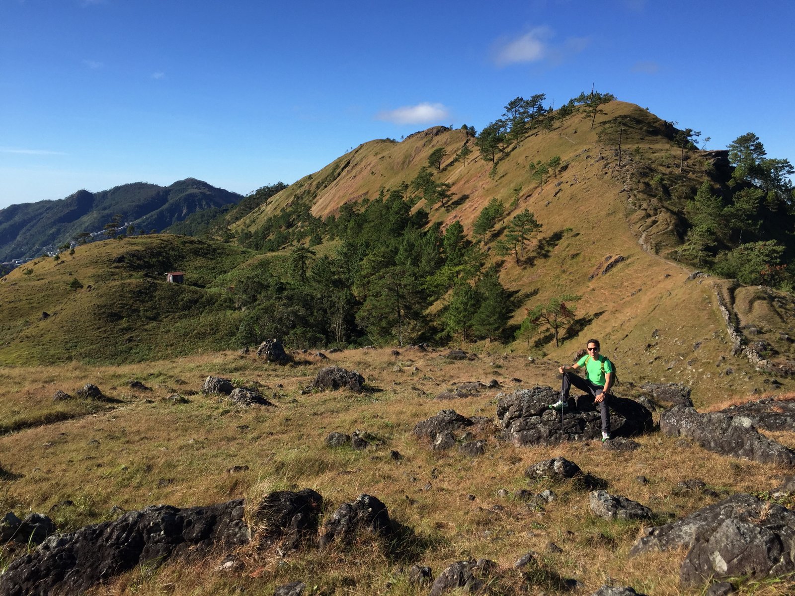
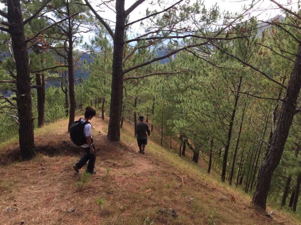
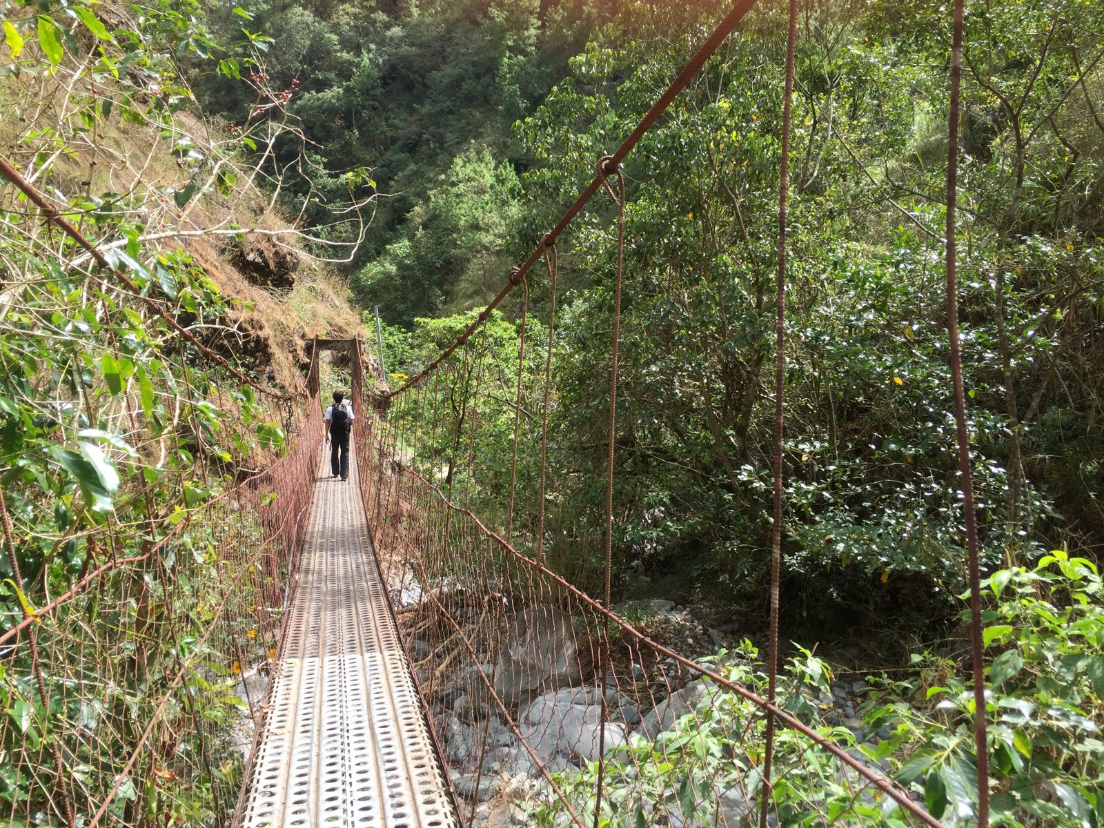
A number of peaks and points of attraction are traversed via this relaxing trail: from the grassland slopes of Ambunao Paoay to Gungal Rock, and then to the highest point, Mt. Ulap (officially 1846m but 1856m according to our measurements). The descent from Mt. Ulap to Pong-ol Burial Caves is akin to the descent from Mt. Ugo summit to Tinongdan, with its steep, pine-forested terrain. The Burial Caves themselves are a nice attraction, and at Sta. Fe there are hanging bridge and cemented footpath that complete the experience.
Once the province of trail runners, the opening up of Mt. Ulap as a hiking destination augurs well for opening up more mountains in the Cordilleras and hopefully people realise that there is much more to the region than Mt. Pulag. Pinoy Mountaineer recommends Mt. Ulap as a dayhike from Baguio and as a sidetrip or warm-up hike to bigger hikes in the region. The only caveat is that because of its popularity it’s becoming inconvenient to hike on weekends – so we are recommending it as a weekday hike – unless you don’t mind enduring the crowds and lengthy queues at Gungol Rock.
ITINERARY
(0100 Take bus from Manila to Baguio)
0600 Take jeepney from Baguio to Brgy. Ampucao (P50)
0640 ETA Brgy. Ampucao. Head to barangay hall. Register / Secure guides
0700 Start trek
0930 ETA Gungol Rock
1030 ETA Mt. Ulap summit
1130 Visit Burial Caves
1300 Arrival at Sta. Fe exit point. Wait for jeepney back to Baguio
1400 Back in Baguio City (and then to Manila)
PRACTICALITIES: MT. ULAP
| Transportation | Public (0) Bus, Cubao or Pasay to Baguio [P460-750; 4-6 hours] (1) Jeepney, Baguio City to Brgy. Ampucao via Philes-Bound route [P50; 40 mins] Approximately 40 minutes travel time from Baguio City Note: It is also possible to rent a taxi from Baguio City to take you all the way to Brgy. Ampucao and back. A P1000 roundtrip would be very reasonable. Private: Proceed to Baguio from Manila, then take the road to Itogon/Philex and make a left turn to Brgy. Ampucao. |
|
| Registration | (1) Logbook at the Ampucao barangay hall complex. P100/person | |
| Guides | Available and required P400/day (as of January 2017) | |
| Contact numbers | Brgy. Ampucao Tourism – 0998-9589549 Van rental (from Manila) – 09182463659 |
|
| Campsites and waypoints ⛺ | Campsites: (1) At Ambunao Paoay 📶 |
|
| Water sources 🚰 | No regular water sources in the Ridge itself except in the lower communities. | |
| Cellphone signal 📶 | Present in most parts of the trails. | |
| River crossings | None | |
| Roped segments / Technical parts | None. | |
| Limatik | None | |
| Lipa | None | |
| Rattan | None | |
| Hiking notes | Exercise caution when taking pictures at the Gungal Rock, as carelessness can be fatal. | |
| Sidetrips | Other trails are being planned in the area. We will update this. From Baguio City, other dayhikes include Mt. Timbak and Mt. Sto. Tomas. | |
| Alternate trails |
|
|
| Dayhikable | Yes (4-6 hours for the entire traverse) | |
| Facilities at jumpoff | (+) Sari-sari stores (+) Restrooms (+) Parking |
|
| Estimated budget | P300-400 from Baguio City for a group of 5 |
MT. ULAP PICTURES
TRIVIA
The Mt. Ulap Eco-Trail used to be part of the TNF 100, along with the longer Philex-Daynet Trail.
The registration regime came into effect on November 1, 2015. The blogger’s visit on November 28, 2015 is narrated in Hiking matters #491.
Leave a Reply
Be the First to Comment!