
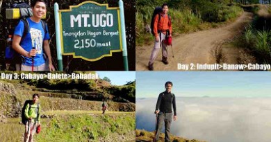
Hiking matters #322: Ugo-Pulag Traverse Day 3 – From Cabayo and Balete to Mt. Pulag’s Babadak Ranger Station


Continued from Hiking matters #321: After a restful night at Cabayo village, we continued our sojourn through the villages of Kayapa and Bokod in an attempt to connect Mt. Ugo and Mt. Pulag in one trek as part of a longer ‘Grand Cordillera Trail’. For the third day, the goal was to reach Babadak Ranger Station, jumpoff of Mt. Pulag’s Ambangeg Trail.

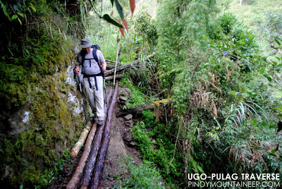
More hanging bridges awaited us from Cabayo to Sitio Abat, some of which were dilapidated and precarious enough to evoke some apprehension on our part. In fact, Kuya Alex ruled out the possibility of night trekking through that section, because of the bridges. My only confidence rested in the fact that these trails are used by the locals on an everyday basis, therefore it must be safe.

Hanging bridges imply the existence of rivers, and indeed, we passed through a beautiful river; for a good hour or two we trekked on a valley, with the slopes of Mt. Purgatory on the west flank, and the slopes of Mt. Pulag in the north, and the slopes of Mt. Pullol in Ambaguio in the east. It was really an awesome experience trekking in places like that beautiful valley, rarely visited as it is by outsiders.

Adding a cultural twist to the scenery, and reminding me of Mt. Amuyao Traverse, we passed through a bit of rice terraces as we approached Sitio Abat. We arrived there at 1040H; after a brief rest stop we proceeded directly to Balete, hoping to reach it early in the afternoon. But it was not to be an easy trail! Reminiscent of Mt. Ambasa the previous day, we had to gain a few hundred meters just to reach the crest, which marks the fork between Brgy. Napo, Ambaguio (NNE, down) and Brgy. Balete, Kayapa (WNW, up).

Though both can lead to Mt. Pulag, we decided to pass through Balete. I wanted to see this trail, since I had already passed through sections of the alternate route, when I did the Akiki-Ambaguio Traverse in 2010. As an early reward for visiting Balete, we saw the stunning waterfalls the locals call Dumanling Falls.

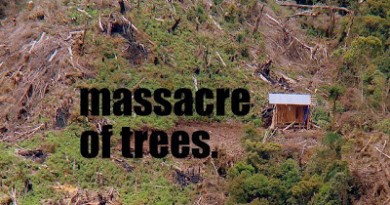
I have mixed feelings about this decision. On one hand, the Balete-Babadak road leads directly to the Ranger Station after about 15 kilometers in a gradual ascent, and passes through mossy forests. On the other hand, it’s more of a rough road now than a trail; habal-habal now pass through, and occasional trucks; it is more like Tapulao of the 1990s. I was saddened to see the fallen trees, once part of the mossy forest, bulldozed in the time of ‘progress’. But is there a mountain community in the Cordillera that does not desire a road to their village?

If it’s any consolation, wild berries, which I suspect thrive in areas with sunlight and high mineral content, were abundant in the trail, and I took time to pick some of them, as is my custom whenever I see such trees in Philippine mountains. I would need the energy: it would still take several hours from Balete before we finally reached Babadak – well into the evening, at around 1940H. But it was a great relief! Once again, I was in familiar territory. We made it!

MT. UGO TRAVERSE TO MT. PULAG
Hiking matters #320: Mt. Ugo Traverse
Hiking matters #321: Indupit – Cabayo
Hiking matters #322: Cabayo – Babadak
Hiking matters #323: Mt. Pulag
Leave a Reply
Be the First to Comment!